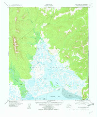
1950 Map of Norton Bay D-6
USGS Topo · Published 1956About this map
The Native Reservation occupies a significant portion of this coastal landscape along Norton Bay, where intricate wetlands meet the foothills of the Seward Peninsula. The 1950 aerial survey captures a complex hydrological network defined by the Tubutulik River and the Kwik River, which meander through expansive Tidal Flats and marshes before reaching the Kwiniuk Inlet. Notable landmarks such as Moses Point and Bald Head anchor the coastline, while inland drainages like Quartz Creek and Horseshoe Creek carve through the rising elevation.
Find a feature on this map
11 named features on this map. Tap any name to fly to it.
Don’t see what you’re looking for? This feature index may not catch every label — zoom into the map to look around manually.
Map Details
Editions of this 1950 Norton Bay D-6 Map
2 editions found
Other maps of this area

1948 · Norton Bay
USGS Topo · 1:250,000

1950 · Bendeleben A-1
USGS Topo · 1:63,360

1950 · Norton Bay D-6
USGS Topo · 1:63,360

1950 · Bendeleben
USGS Topo · 1:250,000

1950 · Norton Bay D-5
USGS Topo · 1:63,360

1950 · Solomon C-1
USGS Topo · 1:63,360

1950 · Norton Bay C-6
USGS Topo · 1:63,360

1950 · Solomon D-1
USGS Topo · 1:63,360

1950 · Solomon
USGS Topo · 1:250,000

1950 · Candle A-6
USGS Topo · 1:63,360