
1950 Map of Norton Bay C-6
USGS Topo · Published 1956About this map
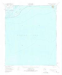
Norton Bay Native Reservation dominates the coastline of this 1950 coastal survey, where the terrestrial landscape meets the expansive waters of Norton Bay. The map records a vital seasonal transportation network, documenting the Winter Trail that segments the shoreline between Moses Point and Isaacs Point. This trail system, including sections noted for their approximate alignment, highlights the reliance on frozen terrain for movement across the Arctic landscape before more permanent road infrastructure existed.
Find a feature on this map
11 named features on this map. Tap any name to fly to it.
Don’t see what you’re looking for? This feature index may not catch every label — zoom into the map to look around manually.
Map Details
Editions of this 1950 Norton Bay C-6 Map
2 editions found
Other maps of this area

1948 · Norton Bay
USGS Topo · 1:250,000

1950 · Norton Bay D-6
USGS Topo · 1:63,360

1950 · Norton Bay B-5
USGS Topo · 1:63,360

1950 · Norton Bay D-5
USGS Topo · 1:63,360

1950 · Solomon C-1
USGS Topo · 1:63,360

1950 · Solomon D-1
USGS Topo · 1:63,360

1950 · Solomon
USGS Topo · 1:250,000

1950 · Norton Bay C-5
USGS Topo · 1:63,360

1951 · Solomon
USGS Topo · 1:250,000

1951 · Norton Bay
USGS Topo · 1:250,000