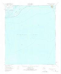
1950 Map of Norton Bay C-6
USGS Topo · Published 1975About this map
Norton Bay Native Reservation dominates the northern shoreline of this mid-century coastal survey, where the terrestrial landscape meets the expansive waters of Norton Bay. The map documents a critical transition point for arctic transit, showing a prominent Winter Trail that skirts the coast and cuts across the seasonal ice and frozen terrain. Near the mouth of the Tubuktulik River, the geography is defined by coastal features like Moses Point and the protected waters of Kwiniuk Inlet. The presence of extensive Tidal Flats suggests a complex shoreline environment that would have dictated traditional subsistence patterns and seasonal movement. Further east along the rugged coast, Bald Head serves as a distinct landmark for coastal navigation in an area where land and sea are deeply interconnected.
Find a feature on this map
8 named features on this map. Tap any name to fly to it.
Don’t see what you’re looking for? This feature index may not catch every label — zoom into the map to look around manually.
Map Details
Editions of this 1950 Norton Bay C-6 Map
2 editions found
Other maps of this area

1948 · Norton Bay
USGS Topo · 1:250,000

1950 · Norton Bay D-6
USGS Topo · 1:63,360

1950 · Norton Bay B-5
USGS Topo · 1:63,360

1950 · Norton Bay D-5
USGS Topo · 1:63,360

1950 · Solomon C-1
USGS Topo · 1:63,360

1950 · Norton Bay C-6
USGS Topo · 1:63,360

1950 · Solomon D-1
USGS Topo · 1:63,360

1950 · Solomon
USGS Topo · 1:250,000

1950 · Norton Bay C-5
USGS Topo · 1:63,360

1951 · Solomon
USGS Topo · 1:250,000