
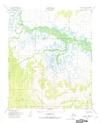
1950 Map of Candle A-6
USGS Topo · Published 1956About this map
The Koyuk River dominates this mid-century landscape, carving a complex network of oxbows and meanders through the northern section of the terrain. Mapped by the Army Map Service using aerial photography from 1949 and 1950, the area is characterized by vast drainage systems where the river creates a wide, watery corridor. To the south, the topographic relief becomes more pronounced, as the Flat upland gives way to the drainage basins of Kelly Creek and the Kwik River. These waterways, along with Salmon Creek, represent the primary natural corridors of a region defined by its hydrology rather than permanent settlements. The intricate patterns of the Koyuk River and its surrounding wetlands suggest a dynamic environment of seasonal changes, offering researchers a look at the Seward Peninsula's interior before significant modern alteration.
Find a feature on this map
8 named features on this map. Tap any name to fly to it.
Don’t see what you’re looking for? This feature index may not catch every label — zoom into the map to look around manually.
Map Details
Editions of this 1950 Candle A-6 Map
2 editions found
Other maps of this area

1948 · Norton Bay
USGS Topo · 1:250,000

1950 · Bendeleben B-1
USGS Topo · 1:63,360

1950 · Bendeleben A-1
USGS Topo · 1:63,360

1950 · Norton Bay D-6
USGS Topo · 1:63,360

1950 · Bendeleben
USGS Topo · 1:250,000

1950 · Norton Bay D-5
USGS Topo · 1:63,360

1950 · Solomon D-1
USGS Topo · 1:63,360

1950 · Solomon
USGS Topo · 1:250,000

1950 · Candle B-5
USGS Topo · 1:63,360

1950 · Candle A-5
USGS Topo · 1:63,360