
1950 Map of Candle B-5
USGS Topo · Published 1956About this map
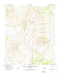
The remote interior of the Seward Peninsula is defined here by the headwaters and tributaries of the Peace River and the Kiwaltik River. During the mid-twentieth century, this landscape remained largely roadless, traversed instead by a network of Tractor Trails that connected isolated mining prospects to the wider region. Evidence of the area's mineral-driven economy is found at a Gold Mine located along Granite Creek, a typical site of the placer mining operations that shaped local settlement patterns in this part of the Second Judicial Division. The drainage systems, including Sweepstakes Creek, Wilson Creek, and Billy Creek, provide the primary geographic framework for a region where water and topography dictated movement long before modern infrastructure. This 1950 survey, mapped by the Army Map Service, captures the intricate contour detail of the uplands before the widespread introduction of permanent roadways.
Find a feature on this map
16 named features on this map. Tap any name to fly to it.
Don’t see what you’re looking for? This feature index may not catch every label — zoom into the map to look around manually.
Map Details
Editions of this 1950 Candle B-5 Map
2 editions found
Other maps of this area

1950 · Candle C-5
USGS Topo · 1:63,360

1950 · Candle A-6
USGS Topo · 1:63,360

1950 · Candle A-5
USGS Topo · 1:63,360

1950 · Candle B-6
USGS Topo · 1:63,360

1950 · Candle C-6
USGS Topo · 1:63,360

1951 · Candle
USGS Topo · 1:250,000

1955 · Candle
USGS Topo · 1:250,000
1955 · Candle A-4
USGS Topo · 1:63,360

1955 · Candle C-4
USGS Topo · 1:63,360
1955 · Candle B-4
USGS Topo · 1:63,360