
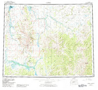
1955 Map of Candle
USGS Topo · Published 1961About this map
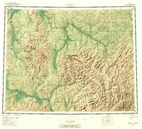
Candle and Buckland anchor this mid-century survey of the Seward Peninsula and adjacent inland regions, illustrating a landscape defined by its river systems and early aviation infrastructure. The map documents several Landing Areas and a network of seasonal routes, including a prominent Tractor Trail cutting through the interior towards Granite Mountain. Waterways like the Kiwalik River and the three forks of the Buckland River serve as the primary geographical markers, while more specialized features such as a Reindeer Corral and various Ditch systems point to the local subsistence and mining economies. Toward the southern extent, the Koyuk River and the settlement of Haycock indicate the spread of activity across the tundra, with Dime Landing serving as a remote waypoint near the Inglutalik River.
Find a feature on this map
78 named features on this map. Tap any name to fly to it.
Don’t see what you’re looking for? This feature index may not catch every label — zoom into the map to look around manually.
Map Details
Editions of this 1955 Candle Map
6 editions found
Other maps of this area

1945 · Nulato
USGS Topo · 1:250,000

1948 · Norton Bay
USGS Topo · 1:250,000

1950 · Kotzebue A-1
USGS Topo · 1:63,360

1950 · Bendeleben C-1
USGS Topo · 1:63,360

1950 · Bendeleben B-1
USGS Topo · 1:63,360

1950 · Bendeleben A-1
USGS Topo · 1:63,360

1950 · Norton Bay D-6
USGS Topo · 1:63,360

1950 · Bendeleben
USGS Topo · 1:250,000

1950 · Candle C-5
USGS Topo · 1:63,360

1950 · Norton Bay D-5
USGS Topo · 1:63,360