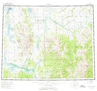
1955 Map of Candle
USGS Topo · Published 1976About this map
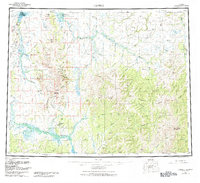
The Continental Divide winds through this terrain of the Seward Peninsula, separating the drainage of the Kiwalik River and Buckland river systems. Near the northern coast, the settlement of Candle sits adjacent to Kiwalik Lagoon, serving as a focal point for activity in an area defined by its remote waterways and the high peaks of Granite Mountain and Bear Mountain. The mapping reveals a sparse network of transport, notably a Tractor Trail cutting through the landscape toward the North Fork Buckland River.
Find a feature on this map
40 named features on this map. Tap any name to fly to it.
Don’t see what you’re looking for? This feature index may not catch every label — zoom into the map to look around manually.
Map Details
Editions of this 1955 Candle Map
6 editions found

Other maps of this area

1945 · Nulato
USGS Topo · 1:250,000

1948 · Norton Bay
USGS Topo · 1:250,000

1950 · Kotzebue A-1
USGS Topo · 1:63,360

1950 · Bendeleben C-1
USGS Topo · 1:63,360

1950 · Bendeleben B-1
USGS Topo · 1:63,360

1950 · Bendeleben A-1
USGS Topo · 1:63,360

1950 · Norton Bay D-6
USGS Topo · 1:63,360

1950 · Bendeleben
USGS Topo · 1:250,000

1950 · Candle C-5
USGS Topo · 1:63,360

1950 · Norton Bay D-5
USGS Topo · 1:63,360