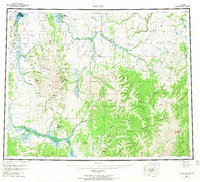
1955 Map of Candle
USGS Topo · Published 1968About this map
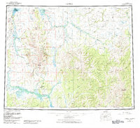
Candle and Buckland anchor this mid-century survey of the Seward Peninsula and surrounding interior, where the Continental Divide winds between the headwaters of major river systems. The landscape is defined by its drainage basins, from the Kiwalik Lagoon in the northwest to the wide reach of the Inglutalik River and Koyuk River in the south. These waterways were the primary arteries for movement, supplemented by a Tractor Trail and a Telephone Line that underscore the era's logistical challenges in the Alaskan bush.
Find a feature on this map
71 named features on this map. Tap any name to fly to it.
Don’t see what you’re looking for? This feature index may not catch every label — zoom into the map to look around manually.
Map Details
Editions of this 1955 Candle Map
6 editions found

Other maps of this area

1945 · Nulato
USGS Topo · 1:250,000

1948 · Norton Bay
USGS Topo · 1:250,000

1950 · Kotzebue A-1
USGS Topo · 1:63,360

1950 · Bendeleben C-1
USGS Topo · 1:63,360

1950 · Bendeleben B-1
USGS Topo · 1:63,360

1950 · Bendeleben A-1
USGS Topo · 1:63,360

1950 · Norton Bay D-6
USGS Topo · 1:63,360

1950 · Bendeleben
USGS Topo · 1:250,000

1950 · Candle C-5
USGS Topo · 1:63,360

1950 · Norton Bay D-5
USGS Topo · 1:63,360