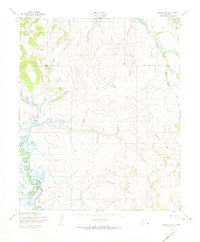
1950 Map of Candle B-6
USGS Topo · Published 1974About this map
The Continental Divide creates a prominent topographical spine across this section of the Seward Peninsula, captured by the Corps of Engineers and Usgs through aerial photography in the mid-twentieth century. The drainage patterns on either side of this divide define the landscape, with the north-flowing Kiwalik River collecting waters from tributaries like Wilson Creek. To the southwest, First Chance Creek cuts through the terrain, suggesting the small-scale drainage systems that characterize this unpopulated Alaskan wilderness. A surveyed Base Line runs east-to-west across the quadrangle, serving as a rare human-imposed geometry in a region where land lines remained unsurveyed and unmarked at the time of mapping.
Find a feature on this map
5 named features on this map. Tap any name to fly to it.
Don’t see what you’re looking for? This feature index may not catch every label — zoom into the map to look around manually.
Map Details
Editions of this 1950 Candle B-6 Map
2 editions found
Other maps of this area

1950 · Bendeleben C-1
USGS Topo · 1:63,360

1950 · Bendeleben B-1
USGS Topo · 1:63,360

1950 · Bendeleben A-1
USGS Topo · 1:63,360

1950 · Bendeleben
USGS Topo · 1:250,000

1950 · Candle C-5
USGS Topo · 1:63,360

1950 · Candle A-6
USGS Topo · 1:63,360

1950 · Candle B-5
USGS Topo · 1:63,360

1950 · Candle A-5
USGS Topo · 1:63,360

1950 · Candle B-6
USGS Topo · 1:63,360

1950 · Candle C-6
USGS Topo · 1:63,360