
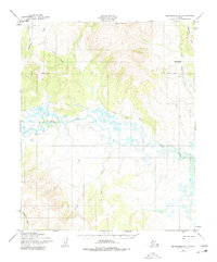
1950 Map of Bendeleben B-1
USGS Topo · Published 1955About this map
The Koyuk River drainage dominates this mid-century survey of the Seward Peninsula, revealing a landscape defined by seasonal movement and remote waterways. In 1950, when these aerial photographs were captured, the region remained largely untouched by permanent infrastructure, save for the Winter Trail, which provided a crucial overland link during the Alaskan freeze. This route skirts the eastern edge of the survey area, navigating the lowlands east of the river's winding course.
Find a feature on this map
9 named features on this map. Tap any name to fly to it.
Don’t see what you’re looking for? This feature index may not catch every label — zoom into the map to look around manually.
Map Details
Editions of this 1950 Bendeleben B-1 Map
2 editions found
Other maps of this area

1950 · Bendeleben C-1
USGS Topo · 1:63,360

1950 · Bendeleben B-2
USGS Topo · 1:63,360

1950 · Bendeleben C-2
USGS Topo · 1:63,360

1950 · Bendeleben A-2
USGS Topo · 1:63,360

1950 · Bendeleben A-1
USGS Topo · 1:63,360

1950 · Bendeleben
USGS Topo · 1:250,000

1950 · Candle A-6
USGS Topo · 1:63,360

1950 · Candle B-6
USGS Topo · 1:63,360

1950 · Candle C-6
USGS Topo · 1:63,360

1951 · Candle
USGS Topo · 1:250,000