
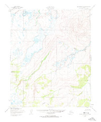
1950 Map of Bendeleben C-2
USGS Topo · Published 1955About this map
The Fairhaven Ditch traces a deliberate path through this portion of the Seward Peninsula, a man-made water conveyance system built to support hydraulic mining operations during the region's gold mining era. This infrastructure cuts across the landscape near Kettle Dome, leading toward a small cluster of Cabins that served as a remote outpost for miners or ditch tenders. The rugged terrain is defined by the convergence of the Burnt River and the Kugruk River, which carve through the high elevations and marshy lowlands of the Bendeleben Mountains.
Find a feature on this map
9 named features on this map. Tap any name to fly to it.
Don’t see what you’re looking for? This feature index may not catch every label — zoom into the map to look around manually.
Map Details
Editions of this 1950 Bendeleben C-2 Map
3 editions found
Other maps of this area

1950 · Bendeleben C-1
USGS Topo · 1:63,360

1950 · Bendeleben C-3
USGS Topo · 1:63,360

1950 · Bendeleben B-2
USGS Topo · 1:63,360

1950 · Bendeleben B-1
USGS Topo · 1:63,360

1950 · Bendeleben B-3
USGS Topo · 1:63,360

1950 · Bendeleben D-2
USGS Topo · 1:63,360

1950 · Bendeleben
USGS Topo · 1:250,000

1950 · Bendeleben D-3
USGS Topo · 1:63,360

1950 · Bendeleben D-1
USGS Topo · 1:63,360

1951 · Bendeleben
USGS Topo · 1:250,000