
1950 Map of Bendeleben C-4
USGS Topo · Published 1955About this map
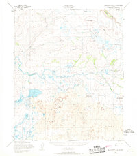
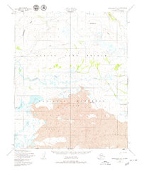
The Noxapaga River winds through this mid-century Alaskan landscape, a remote terrain defined by ancient volcanic activity and sparse seasonal access. Mapped from aerial photography taken in 1949 and 1950, the area is dominated by the sprawling Lava flows that surround prominent volcanic landmarks like Andromeda Cone and Dryas Cone. To the north, the elevated Largo Ridge stands between the drainages of Largo Creek and Berry Creek, while the Goodhope River clips the northeastern corner of the sheet. Human presence is represented only by a solitary Tractor Trail that meanders through the central valley south of the ridge. This map captures a pristine geologic environment, highlighting the isolation and the specific volcanic features that characterize the Bendeleben region before modern infrastructure reached the interior.
Find a feature on this map
14 named features on this map. Tap any name to fly to it.
Don’t see what you’re looking for? This feature index may not catch every label — zoom into the map to look around manually.
Map Details
Editions of this 1950 Bendeleben C-4 Map
3 editions found
Other maps of this area

1950 · Bendeleben C-5
USGS Topo · 1:63,360

1950 · Bendeleben B-5
USGS Topo · 1:63,360

1950 · Bendeleben C-3
USGS Topo · 1:63,360

1950 · Bendeleben B-4
USGS Topo · 1:63,360

1950 · Bendeleben B-3
USGS Topo · 1:63,360

1950 · Bendeleben D-5
USGS Topo · 1:63,360

1950 · Bendeleben
USGS Topo · 1:250,000

1950 · Bendeleben D-3
USGS Topo · 1:63,360

1950 · Bendeleben D-4
USGS Topo · 1:63,360

1951 · Bendeleben
USGS Topo · 1:250,000