
1950 Map of Bendeleben B-5
USGS Topo · Published 1955About this map
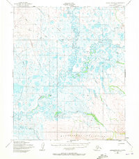
The Bendeleben Mountains anchor the southern boundary of this remote Alaskan landscape, where steep slopes give way to a vast, complex drainage system. This 1950 survey shows a wilderness defined by water, dominated by the winding paths of the Kuzitrin River and the Noxataga River. The lack of permanent settlements emphasizes the region's character as a frontier for subsistence and exploration, with a single Tractor Trail in the northwest serving as the only evidence of overland mechanized travel. Numerous named tributaries, including Bonanza Creek, Birch Creek, and Mabel Creek, snake through the lowland marsh and tundra. These waterways provide a detailed look at the drainage patterns of the Seward Peninsula before modern infrastructure, offering researchers a view of the terrain as it existed mid-century.
Find a feature on this map
15 named features on this map. Tap any name to fly to it.
Don’t see what you’re looking for? This feature index may not catch every label — zoom into the map to look around manually.
Map Details
Editions of this 1950 Bendeleben B-5 Map
3 editions found
Other maps of this area

1950 · Bendeleben C-5
USGS Topo · 1:63,360

1950 · Bendeleben A-6
USGS Topo · 1:63,360

1950 · Bendeleben A-4
USGS Topo · 1:63,360

1950 · Bendeleben B-6
USGS Topo · 1:63,360

1950 · Bendeleben A-5
USGS Topo · 1:63,360

1950 · Bendeleben C-6
USGS Topo · 1:63,360

1950 · Bendeleben B-4
USGS Topo · 1:63,360

1950 · Bendeleben C-4
USGS Topo · 1:63,360

1950 · Bendeleben
USGS Topo · 1:250,000

1951 · Bendeleben
USGS Topo · 1:250,000