
1950 Map of Bendeleben A-5
USGS Topo · Published 1955About this map
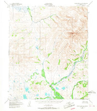
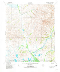
Mount Bendeleben dominates this 1950 topographical survey, serving as the high point for the namesake Bendeleben Mountains in the Second Judicial Division of Alaska. The landscape is defined by an intricate network of drainage systems feeding into the Niukluk River and the Libby River. These watercourses reveal the complex hydraulic character of the Seward Peninsula, with numerous tributaries such as West Fork Libby River, Hash Cr, and Kingsley Cr carving through the terrain. The absence of roads or established settlements on the map underscores the isolation of this region at mid-century, where geographical navigation relied entirely on landmarks like Belt Creek and American Creek. Researchers will find a pristine representation of the Alaskan interior as it was documented through multiplex aerial photography just after World War II.
Find a feature on this map
11 named features on this map. Tap any name to fly to it.
Don’t see what you’re looking for? This feature index may not catch every label — zoom into the map to look around manually.
Map Details
Editions of this 1950 Bendeleben A-5 Map
3 editions found
Other maps of this area

1907 · Casadepaga
USGS Topo · 1:62,500

1950 · Bendeleben A-6
USGS Topo · 1:63,360

1950 · Bendeleben B-5
USGS Topo · 1:63,360

1950 · Bendeleben A-4
USGS Topo · 1:63,360

1950 · Bendeleben B-6
USGS Topo · 1:63,360

1950 · Bendeleben B-4
USGS Topo · 1:63,360

1950 · Bendeleben
USGS Topo · 1:250,000

1950 · Solomon
USGS Topo · 1:250,000

1950 · Solomon D-6
USGS Topo · 1:63,360

1950 · Solomon D-4
USGS Topo · 1:63,360