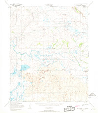
1950 Map of Bendeleben C-4
USGS Topo · Published 1968About this map
The Continental Divide winds through this mid-century landscape on the Seward Peninsula, separating the drainage systems of the Arctic and Pacific slopes. The terrain is dominated by the volcanic legacy of the Lava fields, where the distinct profiles of Dryas Cone and Andromeda Cone rise above the surrounding wetlands. This environment is characterized by a complex network of thermokarst lakes and slow-moving water, most notably Lava Lake and the meandering Noxapaga River. Transport through this remote territory was largely restricted to a single Tractor Trail, which provides a rare man-made reference point across the tundra. The proximity of the Goodhope River and Largo Creek emphasizes the importance of seasonal watercourses in navigating the region before more permanent modern infrastructure arrived. Geologists and surveyors will find the specific elevations and ridgelines of Largo Ridge crucial for understanding the structural layout of this northern volcanic province.
Find a feature on this map
16 named features on this map. Tap any name to fly to it.
Don’t see what you’re looking for? This feature index may not catch every label — zoom into the map to look around manually.
Map Details
Editions of this 1950 Bendeleben C-4 Map
3 editions found
Other maps of this area

1950 · Bendeleben C-5
USGS Topo · 1:63,360

1950 · Bendeleben B-5
USGS Topo · 1:63,360

1950 · Bendeleben C-3
USGS Topo · 1:63,360

1950 · Bendeleben B-4
USGS Topo · 1:63,360

1950 · Bendeleben C-4
USGS Topo · 1:63,360

1950 · Bendeleben B-3
USGS Topo · 1:63,360

1950 · Bendeleben D-5
USGS Topo · 1:63,360

1950 · Bendeleben
USGS Topo · 1:250,000

1950 · Bendeleben D-3
USGS Topo · 1:63,360

1950 · Bendeleben D-4
USGS Topo · 1:63,360