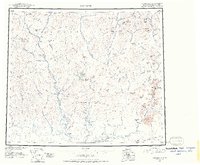
1951 Map of Wiseman
USGS Topo · Published 1957About this map
The Koyukuk River and its myriad tributaries dominate this mid-century survey of the Alaskan interior, centered on the historic mining settlements of the Koyukuk district. At the heart of the region, Wiseman serves as a central hub for the remote territory, while the nearby settlement of Nolan and the landing at Coldfoot indicate the localized activity along the river's eastern banks. The landscape is defined by the massive peaks of the Brooks Range and the Endicott Mountains, with distinctive landmarks like Mt Doonerak, Emma Dome, and Midnight Dome providing navigational anchors across the high-relief terrain. These maps were compiled from original surveys and trimetrogon photography from the 1940s, capturing the area before major modern infrastructure arrived. Traces of early prospector life and local transport are evident in labels for Tramway Bar and Gold Bench, as well as numerous Cabin sites located at strategic points along the Wild River and North Fork Koyukuk River.
Find a feature on this map
128 named features on this map. Tap any name to fly to it.
Don’t see what you’re looking for? This feature index may not catch every label — zoom into the map to look around manually.
Map Details
Editions of this 1951 Wiseman Map
2 editions found
Other maps of this area

1951 · Hughes
USGS Topo · 1:250,000

1951 · Bettles
USGS Topo · 1:250,000

1951 · Survey Pass
USGS Topo · 1:250,000

1951 · Chandler Lake
USGS Topo · 1:250,000

1951 · Chandalar
USGS Topo · 1:250,000

1951 · Brooks
USGS Topo · 1:250,000

1951 · Beaver
USGS Topo · 1:250,000

1951 · Killik River
USGS Topo · 1:250,000

1951 · Wiseman
USGS Topo · 1:250,000

1956 · Chandalar
USGS Topo · 1:250,000