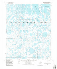
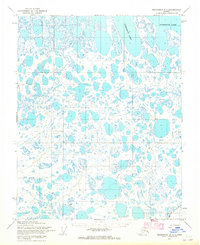
1982 Map of Teshekpuk B-2
USGS Topo · Published 1987About this map
National Petroleum Reserve in Alaska dominates this landscape, where the vast watery expanse of Teshekpuk Lake meets a complex network of unnamed thaw lakes and wetlands. The region, mapped from 1955 aerial photography with minor revisions through the early 1980s, reflects the remote character of the North Slope before significant industrial expansion. A few human markers cross the terrain, including a Winter Trail and a generic Trail that suggest seasonal movement across the frozen tundra. To the south, Kealok Creek meanders through the landscape, showing the natural drainage patterns of this Arctic coastal plain environment. The presence of unsurveyed land lines, predetermined by the Bureau of Land Management, highlights the administrative nature of this territory during its mid-century survey period.
Find a feature on this map
8 named features on this map. Tap any name to fly to it.
Don’t see what you’re looking for? This feature index may not catch every label — zoom into the map to look around manually.
Map Details
Editions of this 1982 Teshekpuk B-2 Map
This is the sole edition of this map. No revisions or reprints were ever made.
Other maps of this area

1951 · Teshekpuk
USGS Topo · 1:250,000

1955 · Teshekpuk
USGS Topo · 1:250,000
1955 · Teshekpuk A-2
USGS Topo · 1:63,360
1955 · Teshekpuk A-3
USGS Topo · 1:63,360
1955 · Teshekpuk B-3
USGS Topo · 1:63,360

1955 · Teshekpuk C-3
USGS Topo · 1:63,360

1955 · Teshekpuk A-1
USGS Topo · 1:63,360
1955 · Teshekpuk B-2
USGS Topo · 1:63,360

1955 · Teshekpuk B-1
USGS Topo · 1:63,360
1955 · Teshekpuk C-2
USGS Topo · 1:63,360