
1955 Map of Teshekpuk
USGS Topo · Published 1962About this map
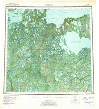
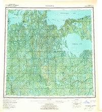
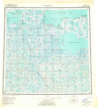
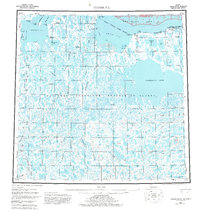
Teshekpuk Lake dominates this Arctic coastal landscape, serving as a massive hydrological hub for a network of winding waterways including the Ikpikpuk River, Alaktak River, and Chip River. The region is defined by its status within the Naval Petroleum Reserve No 4, where early mid-century energy exploration is evidenced by the Simpson Test Well, Avak Test Well, and several noted Oil Seeps near the coast. Along the Beaufort Sea shoreline, isolated outposts like Alaktak and the Kokruagarok (Site) represent the sparse human footprint of the era. Transportation across the thaw-sensitive terrain relied on seasonal routes like the Winter Trail and several remote Landing Strips, including the Lonely Aerodrome at Pitt Point. This survey captures a moment of strategic resource assessment in a landscape shaped by permafrost and coastal inlets like Dease Inlet and Smith Bay.
Find a feature on this map
56 named features on this map. Tap any name to fly to it.
Don’t see what you’re looking for? This feature index may not catch every label — zoom into the map to look around manually.
Map Details
Editions of this 1955 Teshekpuk Map
5 editions found
Other maps of this area

1945 · Barrow
USGS Topo · 1:250,000

1949 · Barrow
USGS Topo · 1:250,000

1951 · Harrison Bay
USGS Topo · 1:250,000

1951 · Meade River
USGS Topo · 1:250,000

1951 · Lookout Ridge
USGS Topo · 1:250,000

1951 · Teshekpuk
USGS Topo · 1:250,000

1951 · Ikpikpuk River
USGS Topo · 1:250,000

1952 · Umiat
USGS Topo · 1:250,000

1955 · Barrow A-2
USGS Topo · 1:63,360

1955 · Barrow
USGS Topo · 1:250,000