Old Maps of Hyder, Alaska for Hiking & Exploration
Hike through history with 5 historic maps of Hyder. Explore old trails, ghost towns, and forgotten backroads — perfect for outdoor adventurers and local explorers.
- Rediscover forgotten places: Map out old mining camps, roads, and footpaths that no longer exist on modern maps.
- Layer with modern tools: Combine with LiDAR or satellite views to plan hikes through historical terrain.
- Made for exploration: Popular among hikers, overlanders, and local history lovers.
Use these maps to find adventure and explore the hidden past of Hyder.
Hyder, AK maps
(5)- 1952 Map of Ketchikan, 1953 Print
 1952 Ketchikan1953 Print · USGSThe Ketchikan region of Southeast Alaska is mapped here in the early fifties, documenting the remote settlements and deep-water inlets of the southern panhandle. Genealogists and historians can trace the foundations of Ketchikan, Metlakatla, and Saxman alongside lonely backcountry cabins.4 unique versions available
 - 1955 Map of Ketchikan D-1, 1960 Print
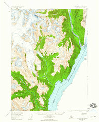 1955 Ketchikan D-11960 Print · USGSThe border community of Hyder and the surrounding ice fields are captured here in the mid-1950s. Genealogists and historians can locate the U.S. Customs station and Wharf along the Portland Canal or trace the reach of the Soule Glacier.2 unique versions available
 - 1955 Map of Ketchikan, 1966 Print
 1955 Ketchikan1966 Print · USGSSoutheast Alaska’s maritime character is captured in the mid-fifties, showing the vital waterways and remote outposts of the Alexander Archipelago. Researchers can trace the waterfronts of Ketchikan and Metlakatla or locate isolated spots like Hyder and Loring.3 unique versions available
 - 2018 Map of Ketchikan D-1 NE, 2018 Print
 2018 Ketchikan D-1 NE2018 Print · USGSCovers Hyder, including Stewart, Unorganized Borough, and other nearby areas
 - 2021 Map of Ketchikan D-1 NE, 2021 Print
 2021 Ketchikan D-1 NE2021 Print · USGSThe remote border community of Hyder and the surrounding wilderness are captured here in the early twenty-first century. Researchers can trace the path of the Salmon River through the Tongass National Forest and locate specific peaks like Trebie Mountain.
End of results
Showing maps 1-5 of 5
Frequently asked questions
- What are the different types of historical maps available for Hyder?
- What is the oldest map of Hyder?
- Where can I purchase historical maps of Hyder for my home or office?
- Where can I download high-res historical maps of Hyder?
- Are there historical topographic maps available for Hyder?
- Is there historical aerial imagery available for Hyder?
- Where are historical maps of Hyder sourced from?