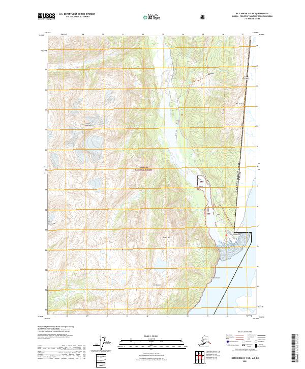
2021 Map of Ketchikan D-1 NE
USGS Topo · Published 2021About this map
Hyder stands as a significant point of entry on the international boundary between Alaska and British Columbia, situated at the head of the Portland Canal. This 2021 survey by the U.S. Geological Survey details the rugged interface between the Tongass National Forest and the peaks of the Coast Mountains. The Salmon River serves as a primary geographical corridor, paralleled by State Highway 12 and the Salmon River Road, which facilitate movement through this complex glacial landscape.
Find a feature on this map
27 named features on this map. Tap any name to fly to it.
Don’t see what you’re looking for? This feature index may not catch every label — zoom into the map to look around manually.
Map Details
Editions of this 2021 Ketchikan D-1 NE Map
This is the sole edition of this map. No revisions or reprints were ever made.
Other maps of this area

1951 · Bradfield Canal
USGS Topo · 1:250,000

1952 · Ketchikan
USGS Topo · 1:250,000

1954 · Bradfield Canal
USGS Topo · 1:250,000

1955 · Bradfield Canal A-1
USGS Topo · 1:63,360

1955 · Ketchikan D-1
USGS Topo · 1:63,360

1955 · Ketchikan
USGS Topo · 1:250,000

1955 · Bradfield Canal
USGS Topo · 1:250,000
1996 · Bradfield Canal A-1
USGS Topo · 1:63,360
1997 · Bradfield Canal A-1
USGS Topo · 1:63,360
2000 · Bradfield Canal A-1
USGS Topo · 1:63,360