
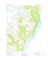
1955 Map of Ketchikan D-1
USGS Topo · Published 1960About this map
Hyder sits at the edge of the Portland Canal, serving as a vital port of entry along the United States Canada border during the mid-1950s. The settlement's infrastructure includes a Wharf and a U.S. Customs office, reflecting its role in international maritime traffic and trade between Alaska and British Columbia. The surrounding landscape of the Tongass National Forest is defined by massive ice fields and steep drainages, including the Soule Glacier and Lincoln Glacier, which feed the Soule River and Salmon River. This survey captures the region just before significant changes in glacial recession, showing the original extents of the Red Mountain Glacier and Thumb Glacier. Landform navigation relies on prominent peaks such as Mount Hinckley and coastal landmarks like Eagle Pt and Salmon Pt that guided mariners through these northern waters.
Find a feature on this map
35 named features on this map. Tap any name to fly to it.
Don’t see what you’re looking for? This feature index may not catch every label — zoom into the map to look around manually.
Map Details
Editions of this 1955 Ketchikan D-1 Map
2 editions found
Other maps of this area

1951 · Bradfield Canal
USGS Topo · 1:250,000

1952 · Ketchikan
USGS Topo · 1:250,000

1954 · Bradfield Canal
USGS Topo · 1:250,000

1955 · Ketchikan D-2
USGS Topo · 1:63,360

1955 · Bradfield canal A-2
USGS Topo · 1:63,360

1955 · Ketchikan C-2
USGS Topo · 1:63,360

1955 · Bradfield Canal A-1
USGS Topo · 1:63,360

1955 · Ketchikan C-1
USGS Topo · 1:63,360

1955 · Ketchikan
USGS Topo · 1:250,000

1955 · Bradfield Canal
USGS Topo · 1:250,000