
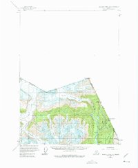
1955 Map of Bradfield Canal A-1
USGS Topo · Published 1959About this map
Texas Glacier and a vast network of ice flows dominate this international border landscape within the Tongass National Forest during the mid-1950s. The map illustrates a high-altitude wilderness where glacial recession is evident in features like Disappearing Lake and the remnants of industrial efforts carved into the mountainsides. Along the Salmon River and Texas Creek, the presence of the Riverside Mine and an Aerial Tramway near Mineral Hill point to the difficult extraction of resources in this environment. Evidence of earlier travel and habitation along the boundary is found at the Boundary Roadhouse (Ruins) and Ninemile (Ruins), marking a period when these remote outposts served as critical stops for those navigating between Alaska and British Columbia. Surveyed during an era of aerial photogrammetry, the map captures the transition between the peak mining years and the preservation of the glacial wilderness.
Find a feature on this map
35 named features on this map. Tap any name to fly to it.
Don’t see what you’re looking for? This feature index may not catch every label — zoom into the map to look around manually.
Map Details
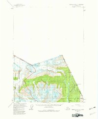
Editions of this 1955 Bradfield Canal A-1 Map
3 editions found
Other maps of this area

1951 · Bradfield Canal
USGS Topo · 1:250,000

1952 · Ketchikan
USGS Topo · 1:250,000

1954 · Bradfield Canal
USGS Topo · 1:250,000

1955 · Bradfield canal B-2
USGS Topo · 1:63,360

1955 · Ketchikan D-2
USGS Topo · 1:63,360

1955 · Bradfield canal A-2
USGS Topo · 1:63,360

1955 · Ketchikan D-1
USGS Topo · 1:63,360

1955 · Ketchikan
USGS Topo · 1:250,000

1955 · Bradfield Canal
USGS Topo · 1:250,000
1973 · Bradfield Canal B-2
USGS Topo · 1:63,360