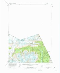
1955 Map of Bradfield Canal A-1
USGS Topo · Published 1975About this map
The international boundary between Alaska and British Columbia carves through a landscape dominated by massive ice fields and the high peaks of the Tongass National Forest. Surveyed in the mid-1950s, this area shows the specialized infrastructure required for high-altitude resource extraction, including an Aerial Tramway and a Tractor Trail leading toward the Riverside Mine near the banks of the Salmon River.
Find a feature on this map
36 named features on this map. Tap any name to fly to it.
Don’t see what you’re looking for? This feature index may not catch every label — zoom into the map to look around manually.
Map Details
Editions of this 1955 Bradfield Canal A-1 Map
3 editions found
Other maps of this area

1951 · Bradfield Canal
USGS Topo · 1:250,000

1952 · Ketchikan
USGS Topo · 1:250,000

1954 · Bradfield Canal
USGS Topo · 1:250,000

1955 · Bradfield canal B-2
USGS Topo · 1:63,360

1955 · Ketchikan D-2
USGS Topo · 1:63,360

1955 · Bradfield canal A-2
USGS Topo · 1:63,360

1955 · Bradfield Canal A-1
USGS Topo · 1:63,360

1955 · Ketchikan D-1
USGS Topo · 1:63,360

1955 · Ketchikan
USGS Topo · 1:250,000

1955 · Bradfield Canal
USGS Topo · 1:250,000