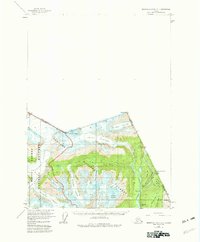
1955 Map of Bradfield Canal A-1
USGS Topo · Published 1982About this map
The United States Canada Boundary defines this high-altitude landscape where the Salmon River valley meets the ice-carved peaks of the Tongass National Forest. Mining and early transport infrastructure are central to the region's character, evidenced by the Riverside Mine and an Aerial Tramway (Aban'd) positioned near Mineral Hill. These features, along with a Tractor Trail following Texas Creek, suggest a history of resource extraction and rugged movement through the glacially dominated terrain.
Find a feature on this map
33 named features on this map. Tap any name to fly to it.
Don’t see what you’re looking for? This feature index may not catch every label — zoom into the map to look around manually.
Map Details
Editions of this 1955 Bradfield Canal A-1 Map
3 editions found
Other maps of this area

1951 · Bradfield Canal
USGS Topo · 1:250,000

1952 · Ketchikan
USGS Topo · 1:250,000

1954 · Bradfield Canal
USGS Topo · 1:250,000

1955 · Bradfield canal B-2
USGS Topo · 1:63,360

1955 · Ketchikan D-2
USGS Topo · 1:63,360

1955 · Bradfield canal A-2
USGS Topo · 1:63,360

1955 · Bradfield Canal A-1
USGS Topo · 1:63,360

1955 · Ketchikan D-1
USGS Topo · 1:63,360

1955 · Ketchikan
USGS Topo · 1:250,000

1955 · Bradfield Canal
USGS Topo · 1:250,000