
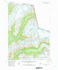
1955 Map of Bradfield canal A-2
USGS Topo · Published 1959About this map
The Tongass National Forest along the international border between Alaska and British Columbia is defined here by massive ice fields and deep river valleys. This mid-century survey reveals a landscape of high alpine peaks such as Mt Blaine and Mt Willibert overlooking an intricate system of moving ice. Significant glacial features including Clarasmith Glacier and the Gracey Creek Glacier feed into the lowlands, while the Chickamin River and King River carve paths through the heavily forested terrain. The map records the precise boundary between the Canada and the United States, passing through landmarks like Mt John Jay and Mt Upshur. This record is particularly valuable for its depiction of the Chickamin Glacier and Through Glacier at a time before significant modern warming began to reshape these perennial ice bodies.
Find a feature on this map
15 named features on this map. Tap any name to fly to it.
Don’t see what you’re looking for? This feature index may not catch every label — zoom into the map to look around manually.
Map Details
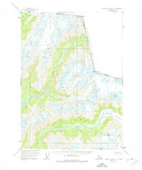
Editions of this 1955 Bradfield canal A-2 Map
3 editions found
Other maps of this area

1951 · Bradfield Canal
USGS Topo · 1:250,000

1952 · Ketchikan
USGS Topo · 1:250,000

1954 · Bradfield Canal
USGS Topo · 1:250,000

1955 · Bradfield canal B-2
USGS Topo · 1:63,360

1955 · Ketchikan D-2
USGS Topo · 1:63,360

1955 · Bradfield canal B-3
USGS Topo · 1:63,360

1955 · Ketchikan D-3
USGS Topo · 1:63,360

1955 · Bradfield Canal A-1
USGS Topo · 1:63,360

1955 · Ketchikan D-1
USGS Topo · 1:63,360

1955 · Bradfield canal A-3
USGS Topo · 1:63,360