Old Maps of Ketchikan Gateway, Alaska
Explore 375 old maps of Ketchikan Gateway, spanning from 1948 to today. These high-resolution historic maps reveal how streets, neighborhoods, landmarks, and natural features evolved over time — perfect for genealogy, metal detecting, research, and local history exploration.
What you can do with these maps:
- See how Ketchikan Gateway changed over time: Compare historical maps to modern-day views to trace roads, homesites, rail lines & more.
- View detailed metadata: Each map includes creators, publishers, year, scale, and archive source.
- Overlay maps with satellite & LiDAR: Visualize the past alongside modern tools to explore terrain & human change.
- Trusted historical sources: Maps sourced from the USGS, Library of Congress, and other archives.
- Access maps your way: View online, download high-res files, or order prints for personal or research use.
Start exploring old maps of Ketchikan Gateway to uncover forgotten places, hidden landmarks, and the deep history beneath your feet.
Ketchikan Gateway, AK maps
(375)- 1948 Map of Prince Rupert D-6, 1957 Print
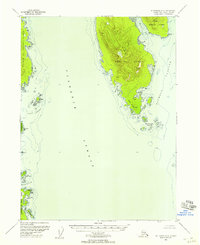
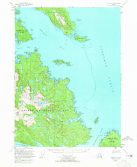
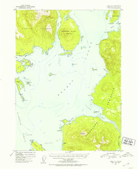
 1948 Prince Rupert D-61957 Print · USGSThe southeastern coast of Prince of Wales Island is documented here just after the war, showing a landscape defined by maritime access and forestry. Researchers can locate isolated signs of development like the mine and cabins tucked into the shores of McLean Arm.
 - 1948 Map of Ketchikan A-6, 1957 Print
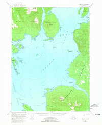
 1948 Ketchikan A-61957 Print · USGSSoutheast Alaska's coastal wilderness comes into focus in the late 1940s, mapping the rugged shores of Gravina Island and Prince of Wales Island. Maritime researchers can trace old anchorages and landmarks like Sawmill, Cabin, and Dall Head.2 unique versions available
 - 1948 Map of Ketchikan C-5, 1964 Print
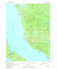
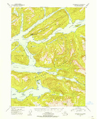
 1948 Ketchikan C-51964 Print · USGSRevillagigedo Island in the late 1940s was a landscape of remote coastal outposts and vital salmon-bearing waterways. Researchers can locate the settlement of Loring, the Black Bear Observation Post, and the Fish Hatchery along the Naha River corridor.3 unique versions available
 - 1949 Map of Ketchikan C-6, 1964 Print
 1949 Ketchikan C-61964 Print · USGSThe Southeast Alaskan coastline in the late 1940s reveals a landscape defined by remote mining operations and maritime navigation. Local historians can trace the sites of the Gold Standard Mine, Alaska Gold Mtn Mines, and cultural landmarks like the Indian Graves near Naha Bay.3 unique versions available
 - 1949 Map of Ketchikan B-4, 1964 Print
 1949 Ketchikan B-41964 Print · USGSSoutheast Alaska's intricate coastline is documented here in the mid-twentieth century as mining and maritime survey efforts shaped the region. Local researchers can locate the Sealavel Mine (Aband) and trace water routes through Thorne Arm and Ella Lake.2 unique versions available
 - 1949 Map of Craig B-1, 1965 Print
 1949 Craig B-11965 Print · USGSPrince of Wales Island and the Alexander Archipelago are captured in the late 1940s, showing a remote maritime landscape before modern infrastructure. Trace secluded waterways like Cholmondeley Sound and landmarks such as Nipple Butte and Grindall Island.2 unique versions available
 - 1949 Map of Craig D-1, 1965 Print
 1949 Craig D-11965 Print · USGSErnest Sound and the Cleveland Peninsula are mapped here just after the war, showing the maritime routes of Southeast Alaska. Trace coastal industry and outposts at the Cannery and remote Cabin sites near Vixen Inlet and Union Bay.3 unique versions available
 - 1950 Map of Craig B-1, 1953 Print
 1950 Craig B-11953 Print · USGSThe maritime landscape of Prince of Wales Island is captured here in the early fifties, showcasing the intricate shoreline of the Tongass National Forest. Researchers can trace historic coastal landmarks and protected inlets like Chasina Anchorage, Saltery Cove, and Clover Lake.2 unique versions available
 - 1950 Map of Craig C-1, 1966 Print
 1950 Craig C-11966 Print · USGSThe rugged coastlines of the Cleveland Peninsula and Prince of Wales Island are captured here in the mid-century era. Historians can trace the legacy of local mining at Sleeping Beauty Mine and locate the site of the former settlement at Hadley.4 unique versions available
 - 1951 Map of Prince Rupert, 1952 Print
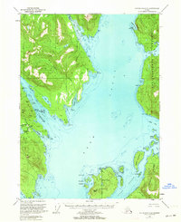
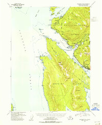
 1951 Prince Rupert1952 Print · USGSThe coastal frontier of Southeast Alaska is captured here in the early fifties, showing the intricate waterways of the Dixon Entrance. Researchers can locate isolated outposts like the Cannery and Vancouver, or trace the rugged coastlines of Duke Island and the Percy Islands.
 - 1951 Map of Bradfield Canal, 1953 Print
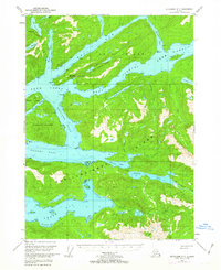
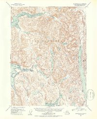
 1951 Bradfield Canal1953 Print · USGSSoutheast Alaska in the early fifties reveals a landscape of massive glaciers and remote waterways along the Canadian border. Researchers can locate early industrial sites like the Riverside Mine and coastal landmarks such as Anan Lagoon or the Government Cabin.3 unique versions available
 - 1951 Map of Craig C-1, 1953 Print
 1951 Craig C-11953 Print · USGSThe Cleveland Peninsula and Prince of Wales Island are shown in the early fifties, documenting a landscape of maritime outposts and dormant mining camps. Genealogists and researchers can trace the abandoned site of Hadley and several inactive operations like the Mamie Mine or Sleeping Beauty Mine.2 unique versions available
 - 1951 Map of Craig D-1, 1953 Print
 1951 Craig D-11953 Print · USGSSoutheast Alaska’s intricate coastline is charted here in the early fifties, detailing the deep waters and islands of the Alexander Archipelago. Researchers can locate remote coastal sites like Cannery (Aband) and family-named landmarks like Petersen Is and Mt Burnett.2 unique versions available
 - 1951 Map of Prince Rupert D-6, 1971 Print
 1951 Prince Rupert D-61971 Print · USGSSoutheast Alaska's rugged Prince of Wales Island coast is captured here in the early fifties, showing a remote world of deep inlets and isolated outposts. Researchers can locate coastal cabins, a remote mine near Mc Lean Arm, and landmarks like Mc Lean Pt.
 - 1952 Map of Ketchikan, 1953 Print
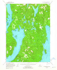
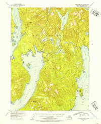
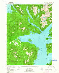
 1952 Ketchikan1953 Print · USGSThe Ketchikan region of Southeast Alaska is mapped here in the early fifties, documenting the remote settlements and deep-water inlets of the southern panhandle. Genealogists and historians can trace the foundations of Ketchikan, Metlakatla, and Saxman alongside lonely backcountry cabins.4 unique versions available
 - 1952 Map of Ketchikan B-4, 1954 Print
 1952 Ketchikan B-41954 Print · USGSRevillagigedo Island in the early fifties shows a wilderness of fjords and mountain peaks before Alaska achieved statehood. Local historians can trace the remnants of maritime industry at the Sealevel Mine (Aband) or locate the isolated Cabin near Gokachin Lakes.2 unique versions available
 - 1952 Map of Ketchikan C-4, 1954 Print
 1952 Ketchikan C-41954 Print · USGSSoutheast Alaska in the early fifties shows a rugged landscape of mountains and water across Revillagigedo Island and the Tongass National Forest. Researchers can trace isolated wilderness outposts including several Shelter Cabins, the Gaging Sta at Ella Lake, and the expansive waters of Lake Grace.2 unique versions available
 - 1952 Map of Ketchikan C-6, 1954 Print
 1952 Ketchikan C-61954 Print · USGSCoastal Southeast Alaska in the early fifties shows a wilderness of islands and waterways shaped by the gold mining industry. Researchers can trace the locations of the Gold Standard Mine (Inactive), the Alaska-Gold Mtn Mines, and isolated structures like the Cabin at Helm Bay.2 unique versions available
 - 1952 Map of Ketchikan D-5, 1963 Print
 1952 Ketchikan D-51963 Print · USGSSoutheast Alaska's intricate coastline is mapped here in the early fifties, showing the isolated outposts and remote waterways of the Alexander Archipelago. Researchers can locate the Seaplane Ramp at Bell Island Hot Springs or trace the drainage from Lake Shelokum to Bailey Bay.3 unique versions available
 - 1952 Map of Ketchikan D-6, 1964 Print
 1952 Ketchikan D-61964 Print · USGSThe Ketchikan region in the early fifties reveals a remote maritime landscape of deep inlets and isolated coastal stations. Genealogists and historians can locate the Fish Hatchery (Aband) at Yes Bay and the Lighthouse Reserve along the Behm Canal.3 unique versions available
 - 1953 Map of Ketchikan C-5, 1954 Print
 1953 Ketchikan C-51954 Print · USGSRevillagigedo Island in the early 1950s was a landscape of remote outposts and coastal inlets. Researchers can locate the settlement of Loring, the Fish Hatchery (Aban'd) at Heckman Lake, and the Black Bear Observation Post near Roosevelt Lagoon.2 unique versions available
 - 1953 Map of Ketchikan B-6, 1955 Print
 1953 Ketchikan B-61955 Print · USGSCoastal life in Southeast Alaska comes into focus in the mid-fifties as industry and wilderness meet along the Tongass Narrows. Trace the early layout of Ketchikan, locate the Cannery at Wards Cove, and find the US Coast Guard Station at Point Higgins.
 - 1953 Map of Ketchikan D-5, 1955 Print
 1953 Ketchikan D-51955 Print · USGSCoastal life in Southeast Alaska centered on isolated outposts and intricate waterways in the years following World War II. Researchers can locate remote cabins and early infrastructure like the Bell Island Hot Springs and its Seaplane Ramp.
 - 1953 Map of Ketchikan D-6, 1955 Print
 1953 Ketchikan D-61955 Print · USGSSoutheast Alaska's maritime landscape is captured here in the mid-fifties, showing the rugged coastline of the Cleveland Peninsula. Historians can trace early regional footprints at the Fish Hatchery (Aban'd) and the Lighthouse Reserve near Yes Bay.
 - 1954 Map of Bradfield Canal
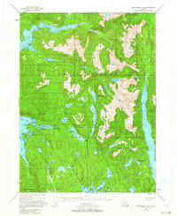
 1954 Bradfield Canal1954 Print · USGSSoutheast Alaska's glacial fjords and high peaks are captured here in the mid-1950s, showing the intersection of the maritime economy and the deep wilderness. Researchers can trace early infrastructure like the Riverside Mine, the Cannery, and the Government Cabin.
Showing maps 1-25 of 375
Top cities of Ketchikan Gateway
Frequently asked questions
- What are the different types of historical maps available for Ketchikan Gateway?
- What is the oldest map of Ketchikan Gateway?
- Where can I purchase historical maps of Ketchikan Gateway for my home or office?
- Where can I download high-res historical maps of Ketchikan Gateway?
- Are there historical topographic maps available for Ketchikan Gateway?
- Is there historical aerial imagery available for Ketchikan Gateway?
- Where are historical maps of Ketchikan Gateway sourced from?