Old Maps of Ketchikan, Alaska
Explore 14 old maps of Ketchikan, spanning from 1952 to today. These high-resolution historic maps reveal how streets, neighborhoods, landmarks, and natural features evolved over time — perfect for genealogy, metal detecting, research, and local history exploration.
What you can do with these maps:
- See how Ketchikan changed over time: Compare historical maps to modern-day views to trace roads, homesites, rail lines & more.
- View detailed metadata: Each map includes creators, publishers, year, scale, and archive source.
- Overlay maps with satellite & LiDAR: Visualize the past alongside modern tools to explore terrain & human change.
- Trusted historical sources: Maps sourced from the USGS, Library of Congress, and other archives.
- Access maps your way: View online, download high-res files, or order prints for personal or research use.
Start exploring old maps of Ketchikan to uncover forgotten places, hidden landmarks, and the deep history beneath your feet.
Ketchikan, AK maps
(14)- 1952 Map of Ketchikan, 1953 Print
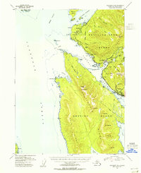
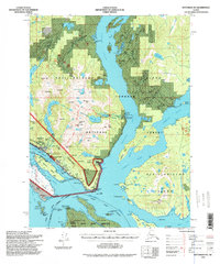
 1952 Ketchikan1953 Print · USGSThe Ketchikan region of Southeast Alaska is mapped here in the early fifties, documenting the remote settlements and deep-water inlets of the southern panhandle. Genealogists and historians can trace the foundations of Ketchikan, Metlakatla, and Saxman alongside lonely backcountry cabins.4 unique versions available
 - 1953 Map of Ketchikan B-6, 1955 Print
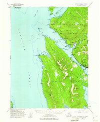
 1953 Ketchikan B-61955 Print · USGSCoastal life in Southeast Alaska comes into focus in the mid-fifties as industry and wilderness meet along the Tongass Narrows. Trace the early layout of Ketchikan, locate the Cannery at Wards Cove, and find the US Coast Guard Station at Point Higgins.
 - 1954 Map of Ketchikan B-5, 1955 Print
 1954 Ketchikan B-51955 Print · USGSCoastal life in the mid-fifties is captured here, centered on the busy waterways of the Tongass Narrows. Researchers can locate the Mahoney Mine, the historic Bayview Cem, and early industrial sites like the Cannery.2 unique versions available
 - 1954 Map of Ketchikan B-6, 1960 Print
 1954 Ketchikan B-61960 Print · USGSSoutheast Alaska in the mid-fifties is defined by the coastal settlements and industrial outposts lining the Tongass Narrows. Maritime and cultural researchers can trace the development of Ketchikan, the facilities at Wacker, and landmarks like Totem Bight.4 unique versions available
 - 1955 Map of Ketchikan, 1966 Print
 1955 Ketchikan1966 Print · USGSSoutheast Alaska’s maritime character is captured in the mid-fifties, showing the vital waterways and remote outposts of the Alexander Archipelago. Researchers can trace the waterfronts of Ketchikan and Metlakatla or locate isolated spots like Hyder and Loring.3 unique versions available
 - 1955 Map of Ketchikan B-5, 1971 Print
 1955 Ketchikan B-51971 Print · USGSSoutheast Alaska’s maritime character is on full display in the mid-fifties, centered on the busy waterfronts of Ketchikan and Saxman. Researchers can trace the era’s industry and community through the Mahoney Mine, China Town, and the Beaver Falls Power House.3 unique versions available
 - 1991 Map of Ketchikan B-5 SW
 1991 Ketchikan B-5 SW1991 Print · USGSThe maritime gateway of Ketchikan and the neighboring community of Saxman are captured here during the 1990s. Researchers can trace the waterfront infrastructure of Ketchikan Harbor and historic locations like China Town on Annette Island.2 unique versions available
 - 1991 Map of Ketchikan B-6 SE
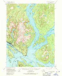
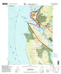
 1991 Ketchikan B-6 SE1991 Print · USGSKetchikan and its neighboring islands are captured in the early 1990s, showing the town's growth along the Tongass Narrows. Trace the unique ferry-access connection between the city and Ketchikan International Airport or explore named peaks like Dall Ridge and Nipple Mountain.
 - 1994 Map of Ketchikan B-5, 1998 Print
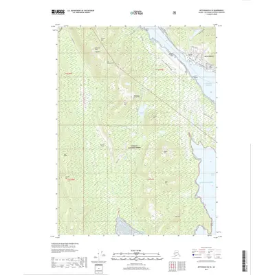
 1994 Ketchikan B-51998 Print · USGSThe Ketchikan waterfront and neighboring Saxman are captured here in the mid-nineties, showing a coastline defined by maritime industry and indigenous heritage. Researchers can trace the development of China Town on Annette Island or locate the site of the Mahoney Mine.
 - 1994 Map of Ketchikan B-6, 1998 Print
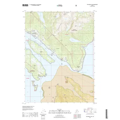
 1994 Ketchikan B-61998 Print · USGSSoutheast Alaska in the 1990s reveals a landscape defined by the maritime economy and the North Tongass Highway corridor. Genealogists and historians can trace coastal development through the US Coast Guard Station, Higgins Elm Sch, and industrial landmarks at Ward Cove.
 - 2017 Map of Ketchikan B-5 SW, 2017 Print
 2017 Ketchikan B-5 SW2017 Print · USGSCovers Ketchikan, including Saxman, Dairy, and other nearby areas
 - 2017 Map of Ketchikan B-6 SE, 2017 Print
 2017 Ketchikan B-6 SE2017 Print · USGSCovers Ketchikan, including Shoreline Drive, Ketchikan Gateway, and other nearby areas
 - 2021 Map of Ketchikan B-6 SE, 2021 Print
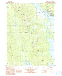
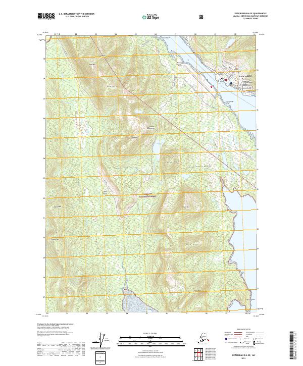 2021 Ketchikan B-6 SE2021 Print · USGSKetchikan and the rugged interior of Gravina Island are captured here during a period of modern coastal expansion. Map collectors can trace the regional infrastructure from the Ketchikan International Airport to the steep peaks of California Ridge and the shores of Bostwick Lake.
 - 2021 Map of Ketchikan B-5 SW, 2021 Print
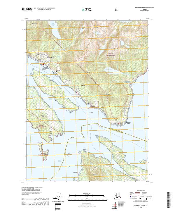 2021 Ketchikan B-5 SW2021 Print · USGSCoastal Alaska's maritime gateway is documented here in the early 2020s, showing the intricate relationship between the shoreline and the steep mountain terrain. Researchers can trace local development from Ketchikan to Saxman, locating landmarks like Bayview Cem and the northern reaches of the Annette Island Reserve.
End of results
Showing maps 1-14 of 14
Top cities near Ketchikan
Frequently asked questions
- What are the different types of historical maps available for Ketchikan?
- What is the oldest map of Ketchikan?
- Where can I purchase historical maps of Ketchikan for my home or office?
- Where can I download high-res historical maps of Ketchikan?
- Are there historical topographic maps available for Ketchikan?
- Is there historical aerial imagery available for Ketchikan?
- Where are historical maps of Ketchikan sourced from?