2020s Maps of Ketchikan, Alaska
Explore 2 historic maps of Ketchikan from the 2020s. These maps offer a rare glimpse into what life looked like during the 2020s — showing old roads, neighborhoods, homes, and landmarks that have changed or disappeared over time.
Whether you're researching your family's past, planning a metal detecting trip, or studying how Ketchikan's landscape evolved across the 2020s, these high-resolution maps are a powerful tool for exploring the history of this region.
- Focus on a specific era: All maps on this page are from the 2020s, giving you a focused view of this time period.
- See what’s changed: Compare century-old streets, trails, and buildings to today's modern landscape using overlays and satellite layers.
- Research with precision: Use these maps for genealogy, historical research, land use analysis, or educational projects.
- View, download, or print: Maps are fully viewable online in high resolution, and can be downloaded or printed for your own records.
Start exploring Ketchikan's history through authentic maps from the 2020s. This is your window into the past.
Ketchikan, AK maps
(2)- 2021 Map of Ketchikan B-6 SE, 2021 Print
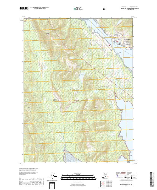 2021 Ketchikan B-6 SE2021 Print · USGSKetchikan and the rugged interior of Gravina Island are captured here during a period of modern coastal expansion. Map collectors can trace the regional infrastructure from the Ketchikan International Airport to the steep peaks of California Ridge and the shores of Bostwick Lake.
 - 2021 Map of Ketchikan B-5 SW, 2021 Print
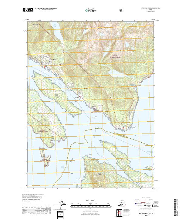 2021 Ketchikan B-5 SW2021 Print · USGSCoastal Alaska's maritime gateway is documented here in the early 2020s, showing the intricate relationship between the shoreline and the steep mountain terrain. Researchers can trace local development from Ketchikan to Saxman, locating landmarks like Bayview Cem and the northern reaches of the Annette Island Reserve.
End of results
Showing maps 1-2 of 2
Top cities near Ketchikan
Frequently asked questions
- What are the different types of historical maps available for Ketchikan?
- What is the oldest map of Ketchikan?
- Where can I purchase historical maps of Ketchikan for my home or office?
- Where can I download high-res historical maps of Ketchikan?
- Are there historical topographic maps available for Ketchikan?
- Is there historical aerial imagery available for Ketchikan?
- Where are historical maps of Ketchikan sourced from?