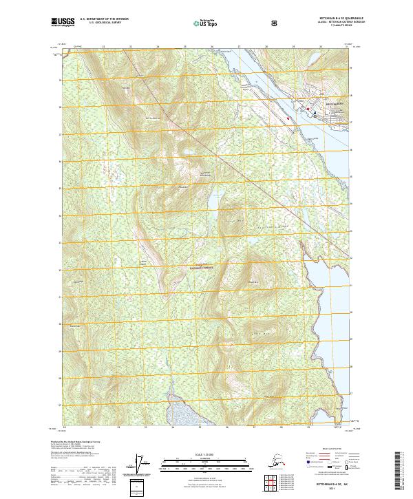
2021 Map of Ketchikan B-6 SE
USGS Topo · Published 2021About this map
Gravina Island and the western reaches of Ketchikan define this coastal landscape within the Tongass National Forest. The map documents the critical infrastructure of the Alexander Archipelago, notably the Ketchikan International Airport separated from the main town by the water. Along the shoreline, established points like Charcoal Point, Bar Point, and East Clump mark the maritime approach to the city. To the west, the interior of the island is dominated by high peaks including Irvin Thompson Mtn and High Mtn, while the Vallenar Valley cuts through the northern terrain. This survey captures a modern era of development where logging roads and thoroughfares like Gravina Island Highway and South Tongass support the regional economy and the University of Alaska Southeast Ketchikan Campus.
Find a feature on this map
42 named features on this map. Tap any name to fly to it.
Don’t see what you’re looking for? This feature index may not catch every label — zoom into the map to look around manually.
Map Details
Editions of this 2021 Ketchikan B-6 SE Map
This is the sole edition of this map. No revisions or reprints were ever made.
Other maps of this area

1948 · Ketchikan A-6
USGS Topo · 1:63,360

1952 · Ketchikan
USGS Topo · 1:250,000

1953 · Ketchikan B-6
USGS Topo · 1:63,360

1954 · Ketchikan B-5
USGS Topo · 1:63,360

1954 · Ketchikan B-6
USGS Topo · 1:63,360

1955 · Ketchikan A-5
USGS Topo · 1:63,360

1955 · Ketchikan
USGS Topo · 1:250,000

1955 · Ketchikan B-5
USGS Topo · 1:63,360
1991 · Ketchikan B-5 SW
USGS Topo · 1:25,000
1991 · Ketchikan B-5 NW
USGS Topo · 1:25,000