
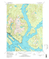
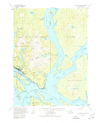
1955 Map of Ketchikan B-5
USGS Topo · Published 1971About this map
The maritime industrial hub of Ketchikan serves as the focal point for this mid-century survey of Revillagigedo Island. This era captures a landscape defined by its reliance on the water, showing a dense concentration of infrastructure along the Tongass Narrows. Essential coastal landmarks include the U.S. Coast Guard Station, a Seaplane Base, and the Thomas Basin harbor. The map also documents the diverse residential and cultural footprint of the period, from the community of Saxman and the specific neighborhood of China Town to the White River Boy Scout Camp in the north.
Find a feature on this map
97 named features on this map. Tap any name to fly to it.
Don’t see what you’re looking for? This feature index may not catch every label — zoom into the map to look around manually.
Map Details
Editions of this 1955 Ketchikan B-5 Map
3 editions found
Other maps of this area

1948 · Ketchikan A-6
USGS Topo · 1:63,360

1948 · Ketchikan C-5
USGS Topo · 1:63,360

1949 · Ketchikan C-6
USGS Topo · 1:63,360

1949 · Ketchikan B-4
USGS Topo · 1:63,360

1952 · Ketchikan
USGS Topo · 1:250,000

1952 · Ketchikan B-4
USGS Topo · 1:63,360

1952 · Ketchikan C-4
USGS Topo · 1:63,360

1952 · Ketchikan C-6
USGS Topo · 1:63,360

1953 · Ketchikan C-5
USGS Topo · 1:63,360

1953 · Ketchikan B-6
USGS Topo · 1:63,360