
1949 Map of Ketchikan C-6
USGS Topo · Published 1964About this map
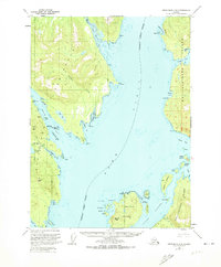
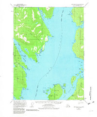
Gold mining prospects and coastal waterways dominate this mid-century survey of the Southeast Alaskan shoreline. On the western landmass, the Gold Standard Mine, Steers Mine, and Alaska Gold Mtn Mines indicate the region's industrial focus on mineral extraction, clustered around the slopes of Gold Mtn. These operations are supported by natural harbors and inlets like Helm Bay and Smugglers Cove. Across the broad reach of the Behm Canal, the landscape shifts to the complex archipelagos of Betton Island and the western edge of Revillagigedo Island.
Find a feature on this map
51 named features on this map. Tap any name to fly to it.
Don’t see what you’re looking for? This feature index may not catch every label — zoom into the map to look around manually.
Map Details
Editions of this 1949 Ketchikan C-6 Map
3 editions found
Other maps of this area

1948 · Ketchikan C-5
USGS Topo · 1:63,360

1949 · Craig B-1
USGS Topo · 1:63,360

1949 · Craig D-1
USGS Topo · 1:63,360

1950 · Craig B-1
USGS Topo · 1:63,360

1950 · Craig C-1
USGS Topo · 1:63,360

1951 · Craig C-1
USGS Topo · 1:63,360

1951 · Craig D-1
USGS Topo · 1:63,360

1952 · Ketchikan
USGS Topo · 1:250,000

1952 · Ketchikan C-6
USGS Topo · 1:63,360

1952 · Ketchikan D-5
USGS Topo · 1:63,360