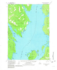
1949 Map of Ketchikan C-6
USGS Topo · Published 1981About this map
Cleveland Peninsula and the western shores of Revillagigedo Island define this coastal landscape as it was documented in the mid-20th century. The waterway of the Behm Canal separates these landmasses, serving as a primary corridor for the region's maritime activity. On the peninsula side, industrial history is evident through the presence of the Gold Standard Mine, Steers Mine, and the Alaska Gold Mtn Mines located near Falls Creek and Smugglers Lake. These sites indicate a period of active resource extraction tucked into the steep coastal terrain.
Find a feature on this map
52 named features on this map. Tap any name to fly to it.
Don’t see what you’re looking for? This feature index may not catch every label — zoom into the map to look around manually.
Map Details
Editions of this 1949 Ketchikan C-6 Map
3 editions found
Other maps of this area

1948 · Ketchikan C-5
USGS Topo · 1:63,360

1949 · Ketchikan C-6
USGS Topo · 1:63,360

1949 · Craig B-1
USGS Topo · 1:63,360

1949 · Craig D-1
USGS Topo · 1:63,360

1950 · Craig B-1
USGS Topo · 1:63,360

1950 · Craig C-1
USGS Topo · 1:63,360

1951 · Craig C-1
USGS Topo · 1:63,360

1951 · Craig D-1
USGS Topo · 1:63,360

1952 · Ketchikan
USGS Topo · 1:250,000

1952 · Ketchikan C-6
USGS Topo · 1:63,360