
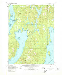
1949 Map of Ketchikan B-4
USGS Topo · Published 1964About this map
Revillagigedo Island presents a complex landscape of deep fjords and interior alpine lakes in this late 1940s survey. The map centers on the glacial geography of the Thorne Arm and Carroll Inlet, where the shoreline is punctuated by landmarks such as Eve Pt and Elf Pt. Evidence of the region's industrial history is found at the Sealavel Mine (Aband) near Beaver Lake, indicating the early 20th-century push for mineral extraction within the Tongass National Forest.
Find a feature on this map
39 named features on this map. Tap any name to fly to it.
Don’t see what you’re looking for? This feature index may not catch every label — zoom into the map to look around manually.
Map Details
Editions of this 1949 Ketchikan B-4 Map
2 editions found
Other maps of this area

1948 · Ketchikan C-5
USGS Topo · 1:63,360

1952 · Ketchikan
USGS Topo · 1:250,000

1952 · Ketchikan B-4
USGS Topo · 1:63,360

1952 · Ketchikan C-4
USGS Topo · 1:63,360

1953 · Ketchikan C-5
USGS Topo · 1:63,360

1954 · Ketchikan B-5
USGS Topo · 1:63,360

1955 · Ketchikan C-3
USGS Topo · 1:63,360

1955 · Ketchikan A-4
USGS Topo · 1:63,360

1955 · Ketchikan A-5
USGS Topo · 1:63,360

1955 · Ketchikan A-3
USGS Topo · 1:63,360