
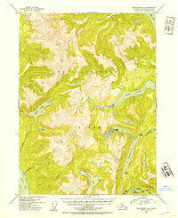
1952 Map of Ketchikan C-4
USGS Topo · Published 1954About this map
Revillagigedo Island dominates this mid-century topographic record, showing a landscape defined by dramatic elevation and freshwater bodies within the Tongass National Forest. At the time of this 1952 survey, the interior remained largely undeveloped, with a network of isolated Shelter Cabins and a Gaging Sta on Ella Lake providing the only evidence of human infrastructure. Significant water features like Lake Grace, Manzanita Lake, and Swan Lake are etched into the steep terrain, while the coastal reaches of Behm Canal and Carroll Inlet mark the edges of the island. The drainage patterns of Manzanita Creek and Calamity Creek illustrate the island's complex hydrology, mapped during an era when aerial photography was beginning to refine the accuracy of Alaskan wilderness surveys. This sheet is essential for understanding the historical footprint of forestry and remote monitoring in the Southeast Alaska panhandle.
Find a feature on this map
18 named features on this map. Tap any name to fly to it.
Don’t see what you’re looking for? This feature index may not catch every label — zoom into the map to look around manually.
Map Details
Editions of this 1952 Ketchikan C-4 Map
2 editions found
Other maps of this area

1948 · Ketchikan C-5
USGS Topo · 1:63,360

1949 · Ketchikan B-4
USGS Topo · 1:63,360

1952 · Ketchikan
USGS Topo · 1:250,000

1952 · Ketchikan B-4
USGS Topo · 1:63,360

1952 · Ketchikan D-5
USGS Topo · 1:63,360

1953 · Ketchikan C-5
USGS Topo · 1:63,360

1953 · Ketchikan D-5
USGS Topo · 1:63,360

1954 · Ketchikan B-5
USGS Topo · 1:63,360

1955 · Ketchikan C-3
USGS Topo · 1:63,360

1955 · Ketchikan D-4
USGS Topo · 1:63,360