
1950 Map of Craig B-1
USGS Topo · Published 1953About this map
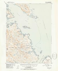
Prince of Wales Island dominates this mid-century topographic study, revealing the complex maritime geography of the Alexander Archipelago before modern development. The map details the intricate coastlines and deep-water inlets that define the region's character, including the sprawling Skowl Arm and the protected waters of Chasina Anchorage. Navigation markers and topographic elevations provide a clear picture of the land-and-sea interface within the Tongass National Forest, from the heights of Clover Mtn and Nipple Butte to the sheltered interior of Clover Lake. The presence of labels like Saltery Cove and Trollers Cove points toward the established fishing and maritime traditions of the era. The mapping of small landforms such as Grindall Island and Patterson Island reflects the precision of early 1950s aerial photography and hydrographic compilation used to chart these Alaskan waters.
Find a feature on this map
47 named features on this map. Tap any name to fly to it.
Don’t see what you’re looking for? This feature index may not catch every label — zoom into the map to look around manually.
Map Details
Editions of this 1950 Craig B-1 Map
2 editions found
Other maps of this area

1948 · Ketchikan A-6
USGS Topo · 1:63,360

1948 · Craig A-1
USGS Topo · 1:63,360

1948 · Craig A-2
USGS Topo · 1:63,360

1949 · Craig C-2
USGS Topo · 1:63,360

1949 · Craig B-2
USGS Topo · 1:63,360

1949 · Ketchikan C-6
USGS Topo · 1:63,360

1949 · Craig B-1
USGS Topo · 1:63,360

1950 · Craig C-1
USGS Topo · 1:63,360

1951 · Craig B-2
USGS Topo · 1:63,360

1951 · Craig C-2
USGS Topo · 1:63,360