
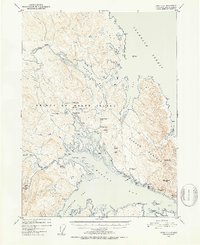
1951 Map of Craig C-2
USGS Topo · Published 1953About this map
The settlement of Kasaan and the surrounding copper and gold mining operations on the Kasaan Peninsula define this early 1950s survey of Prince of Wales Island. Industrial activity is visible through a network of extraction sites, including the Salt Chuck Mine, Haida Mine, and the Flagstaff Mine, which utilized an Aerial Tramway for transport. Along the coast of Kasaan Bay, infrastructure for the maritime and fishing industry is noted by a Cannery and an Oil Tank.
Find a feature on this map
68 named features on this map. Tap any name to fly to it.
Don’t see what you’re looking for? This feature index may not catch every label — zoom into the map to look around manually.
Map Details
Editions of this 1951 Craig C-2 Map
2 editions found
Other maps of this area

1949 · Craig D-3
USGS Topo · 1:63,360

1949 · Craig C-2
USGS Topo · 1:63,360

1949 · Craig D-2
USGS Topo · 1:63,360

1949 · Craig B-2
USGS Topo · 1:63,360

1949 · Craig B-3
USGS Topo · 1:63,360

1949 · Craig C-3
USGS Topo · 1:63,360

1949 · Craig B-1
USGS Topo · 1:63,360

1949 · Craig D-1
USGS Topo · 1:63,360

1950 · Craig D-3
USGS Topo · 1:63,360

1950 · Craig B-1
USGS Topo · 1:63,360