
1948 Map of Ketchikan C-5
USGS Topo · Published 1964About this map
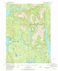
Revillagigedo Island presents a landscape defined by deep fjords and an intricate network of freshwater lakes, as documented in this 1948 survey. The small settlement of Loring on Naha Bay serves as a primary coastal anchor, featuring a Seaplane Base and nearby Tanks. The interior is accessible largely by water, with the Naha River system connecting a chain of significant bodies including Roosevelt Lagoon, Jordan Lake, and Heckman Lake. Local resource management and early wilderness monitoring are evidenced by the presence of a Fish Hatchery near the river and the Black Bear Observation Post situated between the lagoons. To the east, the massive Carroll Inlet cuts deep into the landmass, while the northern reaches are dominated by Traitors Cove and Bluff Lake. This map records a time when commercial and scientific footprints in the Tongass National Forest were concentrated at specific coastal inlets and river mouths.
Find a feature on this map
42 named features on this map. Tap any name to fly to it.
Don’t see what you’re looking for? This feature index may not catch every label — zoom into the map to look around manually.
Map Details
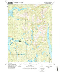
Editions of this 1948 Ketchikan C-5 Map
3 editions found
Other maps of this area

1949 · Ketchikan C-6
USGS Topo · 1:63,360

1949 · Ketchikan B-4
USGS Topo · 1:63,360

1952 · Ketchikan
USGS Topo · 1:250,000

1952 · Ketchikan B-4
USGS Topo · 1:63,360

1952 · Ketchikan C-4
USGS Topo · 1:63,360

1952 · Ketchikan C-6
USGS Topo · 1:63,360

1952 · Ketchikan D-5
USGS Topo · 1:63,360

1952 · Ketchikan D-6
USGS Topo · 1:63,360

1953 · Ketchikan C-5
USGS Topo · 1:63,360

1953 · Ketchikan B-6
USGS Topo · 1:63,360