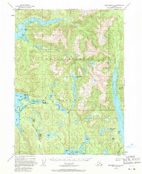
1948 Map of Ketchikan C-5
USGS Topo · Published 1971About this map
Revillagigedo Island presents a complex network of freshwater lakes and saltwater inlets in the years following World War II. The settlement of Loring on Naha Bay serves as a primary point of human activity, supported by a nearby Seaplane Base and proximity to Dogfish Island. The interior geography is defined by a dense sequence of water bodies, including Margaret Lake, Emma Lake, and the elongated Patching Lake, which feed into the deep coastal incisions of George Inlet and Carroll Inlet.
Find a feature on this map
43 named features on this map. Tap any name to fly to it.
Don’t see what you’re looking for? This feature index may not catch every label — zoom into the map to look around manually.
Map Details
Editions of this 1948 Ketchikan C-5 Map
3 editions found
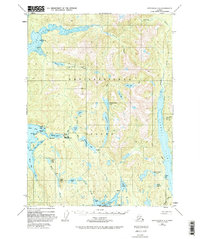
Other maps of this area

1948 · Ketchikan C-5
USGS Topo · 1:63,360

1949 · Ketchikan C-6
USGS Topo · 1:63,360

1949 · Ketchikan B-4
USGS Topo · 1:63,360

1952 · Ketchikan
USGS Topo · 1:250,000

1952 · Ketchikan B-4
USGS Topo · 1:63,360

1952 · Ketchikan C-4
USGS Topo · 1:63,360

1952 · Ketchikan C-6
USGS Topo · 1:63,360

1952 · Ketchikan D-5
USGS Topo · 1:63,360

1952 · Ketchikan D-6
USGS Topo · 1:63,360

1953 · Ketchikan C-5
USGS Topo · 1:63,360