
1951 Map of Prince Rupert D-6
USGS Topo · Published 1971About this map
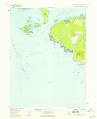
The southeastern shoreline of Prince of Wales Island fronts the expansive Clarence Strait in this early 1950s survey. This remote maritime landscape within the Tongass National Forest is defined by a series of deep inlets and protected harbors, including Ingraham Bay, Kendrick Bay, and the long reach of Mc Lean Arm. Settlement here is minimal, indicated only by scattered cabins along the water’s edge, reflecting a period when seasonal fishing and coastal resource extraction were the primary drivers of activity. A single mine is noted near the head of McLean Arm, suggesting the localized mineral prospecting common in Southeast Alaska at mid-century. The intricate coastline is dotted with navigationally significant landmarks like Mc Lean Pt, Orca Island Pt, and the Kendrick Islands, providing a detailed view of this maritime wilderness before modern industrial changes.
Find a feature on this map
16 named features on this map. Tap any name to fly to it.
Don’t see what you’re looking for? This feature index may not catch every label — zoom into the map to look around manually.
Map Details
Editions of this 1951 Prince Rupert D-6 Map
This is the sole edition of this map. No revisions or reprints were ever made.
Other maps of this area

1948 · Prince Rupert D-6
USGS Topo · 1:63,360

1948 · Dixon Entrance C-1
USGS Topo · 1:63,360

1948 · Ketchikan A-6
USGS Topo · 1:63,360

1948 · Craig A-1
USGS Topo · 1:63,360

1948 · Dixon Entrance D-1
USGS Topo · 1:63,360

1951 · Prince Rupert
USGS Topo · 1:250,000

1951 · Dixon Entrance
USGS Topo · 1:250,000

1952 · Ketchikan
USGS Topo · 1:250,000

1955 · Ketchikan A-5
USGS Topo · 1:63,360
1955 · Prince Rupert D-5
USGS Topo · 1:63,360