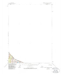
1973 Map of Bradfield Canal B-2
USGS Topo · Published 1998About this map
The international boundary between Alaska and British Columbia cuts across this high-altitude landscape, where the Canada-United States border is defined by the peaks of the Coast Mountains. Much of the southwestern portion of the map is protected within the Tongass National Forest, a terrain dominated by significant ice features and alpine lakes. Mt Middleton serves as a prominent landmark in this glacial environment, situated north of Gracey Creek Glacier. This 1973 revision, based on earlier 1950s field data, captures a wilderness area with no roads or trails, where the land is primarily characterized by the movement of ice and the presence of high-elevation water bodies like Smith Lake and a smaller unnamed Lake.
Find a feature on this map
7 named features on this map. Tap any name to fly to it.
Don’t see what you’re looking for? This feature index may not catch every label — zoom into the map to look around manually.
Map Details
Editions of this 1973 Bradfield Canal B-2 Map
This is the sole edition of this map. No revisions or reprints were ever made.
Other maps of this area

1951 · Bradfield Canal
USGS Topo · 1:250,000

1954 · Bradfield Canal
USGS Topo · 1:250,000

1955 · Bradfield canal B-2
USGS Topo · 1:63,360

1955 · Bradfield canal B-3
USGS Topo · 1:63,360

1955 · Bradfield canal A-2
USGS Topo · 1:63,360

1955 · Bradfield Canal A-1
USGS Topo · 1:63,360

1955 · Bradfield canal A-3
USGS Topo · 1:63,360

1955 · Bradfield Canal
USGS Topo · 1:250,000
1996 · Bradfield Canal A-1
USGS Topo · 1:63,360
1997 · Bradfield Canal A-1
USGS Topo · 1:63,360