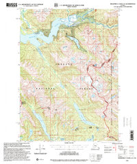
1997 Map of Bradfield Canal A-1
USGS Topo · Published 2000About this map
Bradfield Canal and its tidal flats dominate this coastal Alaskan landscape, where the Bradfield River and Harding River meet the sea. The 1997 revision reflects the infrastructure of the Tongass National Forest, including several remote Forest Service outposts such as Harding River Cabin (FS), Eagle Lake Cabin (FS), and Reflection Lake Cabin (FS). A long-distance powerline cuts through the terrain, connecting a Powerhouse near Tyee Lake to the broader regional grid.
Find a feature on this map
43 named features on this map. Tap any name to fly to it.
Don’t see what you’re looking for? This feature index may not catch every label — zoom into the map to look around manually.
Map Details
Editions of this 1997 Bradfield Canal A-1 Map
This is the sole edition of this map. No revisions or reprints were ever made.
Other maps of this area

1951 · Bradfield Canal
USGS Topo · 1:250,000

1952 · Ketchikan
USGS Topo · 1:250,000

1954 · Bradfield Canal
USGS Topo · 1:250,000

1955 · Bradfield canal B-2
USGS Topo · 1:63,360

1955 · Ketchikan D-2
USGS Topo · 1:63,360

1955 · Bradfield canal A-2
USGS Topo · 1:63,360

1955 · Bradfield Canal A-1
USGS Topo · 1:63,360

1955 · Ketchikan D-1
USGS Topo · 1:63,360

1955 · Ketchikan
USGS Topo · 1:250,000

1955 · Bradfield Canal
USGS Topo · 1:250,000