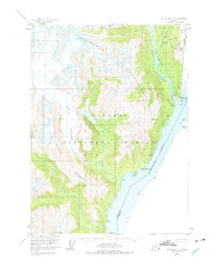
1955 Map of Ketchikan D-1
USGS Topo · Published 1975About this map
The border community of Hyder sits at the head of the Portland Canal, serving as a critical gateway between Alaska and British Columbia. This mid-century survey captures the industrial and civic footprint of the settlement, including the Po, US Customs, and a Wharf along the shoreline. The transition from maritime transport to mountain extraction is evident in the presence of an Aerial Tramway (Aband) and a Slide located near Titan Creek.
Find a feature on this map
54 named features on this map. Tap any name to fly to it.
Don’t see what you’re looking for? This feature index may not catch every label — zoom into the map to look around manually.
Map Details
Editions of this 1955 Ketchikan D-1 Map
2 editions found
Other maps of this area

1951 · Bradfield Canal
USGS Topo · 1:250,000

1952 · Ketchikan
USGS Topo · 1:250,000

1954 · Bradfield Canal
USGS Topo · 1:250,000

1955 · Ketchikan D-2
USGS Topo · 1:63,360

1955 · Bradfield canal A-2
USGS Topo · 1:63,360

1955 · Ketchikan C-2
USGS Topo · 1:63,360

1955 · Bradfield Canal A-1
USGS Topo · 1:63,360

1955 · Ketchikan D-1
USGS Topo · 1:63,360

1955 · Ketchikan C-1
USGS Topo · 1:63,360

1955 · Ketchikan
USGS Topo · 1:250,000