1955 Map of Ketchikan C-2
USGS Topo · Published 1959About this map
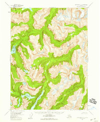
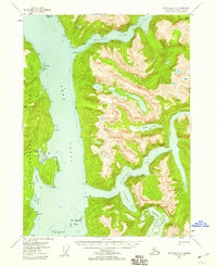
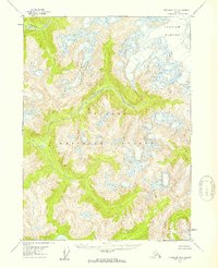
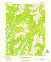
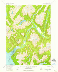
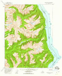
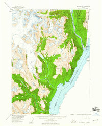
The Adam Mountains dominate this 1950s study of the Southeast Alaskan interior, where glacial activity and high-elevation hydrology define the landscape. Situated entirely within the Tongass National Forest, the region shows a complex network of alpine lakes and drainage systems, most notably the long, narrow Wilson Lake and the nearby Goat Lake. A single Cabin located at the northern tip of Wilson Lake marks the only human settlement on the sheet, suggesting a landscape used primarily for seasonal transit or wilderness trapping during the mid-twentieth century. Water flows from these heights toward the coast, with the Blossom River carving a significant valley in the southeast and Walker Creek draining the northern slopes. To the west, the deep inlet of Rudyard Bay reaches into the mountainous terrain, illustrating the typical fjord-like geography of the Alexander Archipelago.
Find a feature on this map
9 named features on this map. Tap any name to fly to it.
Don’t see what you’re looking for? This feature index may not catch every label — zoom into the map to look around manually.
Map Details
Editions of this 1955 Ketchikan C-2 Map
2 editions found

Other maps of this area

1952 · Ketchikan
USGS Topo · 1:250,000
1955 · Ketchikan C-3
USGS Topo · 1:63,360
1955 · Ketchikan D-2
USGS Topo · 1:63,360
1955 · Ketchikan B-2
USGS Topo · 1:63,360
1955 · Ketchikan D-3
USGS Topo · 1:63,360
1955 · Ketchikan B-1
USGS Topo · 1:63,360
1955 · Ketchikan D-1
USGS Topo · 1:63,360

1955 · Ketchikan B-3
USGS Topo · 1:63,360

1955 · Ketchikan C-1
USGS Topo · 1:63,360

1955 · Ketchikan
USGS Topo · 1:250,000