Old Maps of Niblack, Alaska for Genealogy
Trace your family roots with 5 historic maps of Niblack. These high-res maps reveal old neighborhoods, homesites, landmarks, and streets — helping you uncover where your ancestors lived and how the area evolved over time.
- Explore historic neighborhoods: Identify where your relatives may have lived in the 1800s or 1900s.
- Compare maps over time: Trace the changes in streets, buildings, and landmarks for multi-generational research.
- Perfect for genealogy & ancestry research: Used by family historians and researchers to map out lineage and migration.
These maps are an incredible resource for exploring your personal connection to Niblack's past.
Niblack, AK maps
(5)- 1948 Map of Craig A-1, 1957 Print
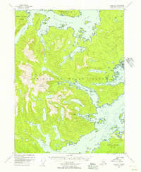 1948 Craig A-11957 Print · USGSPrince of Wales Island in the post-war years shows a remote coastal economy transitioning away from early twentieth-century sites. Researchers can locate former centers like Dolomie and Niblack or trace activity at the Cannery and Mine.4 unique versions available
 - 1957 Map of Craig, 1959 Print
 1957 Craig1959 Print · USGSSoutheast Alaska’s intricate archipelago is revealed in the mid-1950s, detailing a coastal economy driven by remote mines and fishing outposts. Genealogists and historians can trace family roots in Craig, Hydaburg, and Klawak, or locate former sites like Tuxekan and the Salt Chuck Mine.3 unique versions available
 - 1997 Map of Craig A-1, 2000 Print
 1997 Craig A-12000 Print · USGSSoutheastern Prince of Wales Island is shown in the late 1990s as a landscape of deep sounds and remote wilderness. Local historians can trace the status of sites like Chomly, the Logging Camp at Johnson Port, and the rugged peaks of Eudora Mountain.
 - 2017 Map of Craig A-1 SE, 2017 Print
 2017 Craig A-1 SE2017 Print · USGSCovers Niblack, including Unorganized Borough, Prince of Wales-Hyder, and other nearby areas
 - 2021 Map of Craig A-1 SE, 2021 Print
 2021 Craig A-1 SE2021 Print · USGSPrince of Wales Island's intricate southern coastline is charted here in the twenty-first century, revealing a landscape of deep fjords and dense forest. Trace maritime history through Niblack Anchorage and the industrial remnants at Cannery Cove.
End of results
Showing maps 1-5 of 5
Frequently asked questions
- What are the different types of historical maps available for Niblack?
- What is the oldest map of Niblack?
- Where can I purchase historical maps of Niblack for my home or office?
- Where can I download high-res historical maps of Niblack?
- Are there historical topographic maps available for Niblack?
- Is there historical aerial imagery available for Niblack?
- Where are historical maps of Niblack sourced from?