Old Maps of Birches, Alaska
Explore 5 old maps of Birches, spanning from 1951 to today. These high-resolution historic maps reveal how streets, neighborhoods, landmarks, and natural features evolved over time — perfect for genealogy, metal detecting, research, and local history exploration.
What you can do with these maps:
- See how Birches changed over time: Compare historical maps to modern-day views to trace roads, homesites, rail lines & more.
- View detailed metadata: Each map includes creators, publishers, year, scale, and archive source.
- Overlay maps with satellite & LiDAR: Visualize the past alongside modern tools to explore terrain & human change.
- Trusted historical sources: Maps sourced from the USGS, Library of Congress, and other archives.
- Access maps your way: View online, download high-res files, or order prints for personal or research use.
Start exploring old maps of Birches to uncover forgotten places, hidden landmarks, and the deep history beneath your feet.
Birches, AK maps
(5)- 1951 Map of Melozitna, 1952 Print
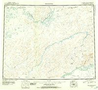 1951 Melozitna1952 Print · USGSThe Yukon and Koyukuk Rivers converge in this interior Alaskan wilderness during the mid-twentieth century. Researchers can locate remote outposts like Birches and Kallands or trace early mining activity at the Placer Mine near Gold Mountain.2 unique versions available
 - 1952 Map of Melozitna A-2, 1957 Print
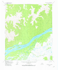
 1952 Melozitna A-21957 Print · USGSThe Alaskan interior along the Yukon River was still a frontier of remote outposts and seasonal camps during the early 1950s. Genealogists and historians can locate a Native Fishing Camp, the Landing Strip (CAA), and isolated Cabins tucked away near Gold Mountain.
 - 1953 Map of Melozitna A-2, 1973 Print
 1953 Melozitna A-21973 Print · USGSThe Yukon River corridor near Birches is documented here in the early fifties, showing a landscape defined by seasonal fishing and river navigation. Local historians can trace the riverside Native Fishing Camp, the remote Landing Strip, and landmarks like Gold Mountain or Lady Island.2 unique versions available
 - 1956 Map of Melozitna, 1961 Print
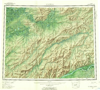 1956 Melozitna1961 Print · USGSInterior Alaska in the mid-fifties is captured here as a vast network of rivers and seasonal fishing grounds. Researchers can trace traditional sites like Twelvemile Fishing Camp, the remote settlement of Utopia, and the geothermal Melozitna Hot Springs.5 unique versions available
 - 2016 Map of Melozitna A-2 NE, 2016 Print
 2016 Melozitna A-2 NE2016 Print · USGSThe Yukon River corridor near the settlement of Birches comes into focus in this recent survey. Local researchers can trace the relationship between the river bank and high landmarks like Gold Mtn across several township boundaries.
End of results
Showing maps 1-5 of 5
Frequently asked questions
- What are the different types of historical maps available for Birches?
- What is the oldest map of Birches?
- Where can I purchase historical maps of Birches for my home or office?
- Where can I download high-res historical maps of Birches?
- Are there historical topographic maps available for Birches?
- Is there historical aerial imagery available for Birches?
- Where are historical maps of Birches sourced from?