1900s (20th Century) Maps of Moses Point, Alaska
Explore 3 historic maps of Moses Point from the 1900s (20th Century). These maps offer a rare glimpse into what life looked like during the 1900s — showing old roads, neighborhoods, homes, and landmarks that have changed or disappeared over time.
Whether you're researching your family's past, planning a metal detecting trip, or studying how Moses Point's landscape evolved across the 1900s, these high-resolution maps are a powerful tool for exploring the history of this region.
- Focus on a specific era: All maps on this page are from the 1900s, giving you a focused view of this time period.
- See what’s changed: Compare century-old streets, trails, and buildings to today's modern landscape using overlays and satellite layers.
- Research with precision: Use these maps for genealogy, historical research, land use analysis, or educational projects.
- View, download, or print: Maps are fully viewable online in high resolution, and can be downloaded or printed for your own records.
Start exploring Moses Point's history through authentic maps from the 1900s. This is your window into the past.
Moses Point, AK maps
(3)- 1950 Map of Solomon C-1, 1956 Print
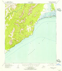 1950 Solomon C-11956 Print · USGSNorton Bay and the Seward Peninsula coast appear here in the early fifties as the region relied on seasonal routes and coastal outposts. Researchers can trace the Winter Trail connecting Elim and Walla Walla past the Moses Point Fishing Village.4 unique versions available
 - 1950 Map of Solomon, 1956 Print
 1950 Solomon1956 Print · USGSThe southern Seward Peninsula is captured here in the mid-1950s, showing a landscape defined by coastal outposts and inland mining camps. Trace historic routes like the Winter Trail or locate the Big Hurrah Mine and Ruby Roadhouse.5 unique versions available
 - 1951 Map of Solomon
 1951 Solomon1951 Print · USGSThe Seward Peninsula during the mid-century shows the intricate network of mining trails and coastal outposts that followed the gold rushes. Researchers can trace the Seward Peninsula Railroad and locate interior settlements like Council or the Big Hurrah Mine.3 unique versions available
End of results
Showing maps 1-3 of 3
Top cities near Moses Point
Frequently asked questions
- What are the different types of historical maps available for Moses Point?
- What is the oldest map of Moses Point?
- Where can I purchase historical maps of Moses Point for my home or office?
- Where can I download high-res historical maps of Moses Point?
- Are there historical topographic maps available for Moses Point?
- Is there historical aerial imagery available for Moses Point?
- Where are historical maps of Moses Point sourced from?