Old Maps of Cedar Ridge, Arizona
Explore 13 old maps of Cedar Ridge, spanning from 1886 to today. These high-resolution historic maps reveal how streets, neighborhoods, landmarks, and natural features evolved over time — perfect for genealogy, metal detecting, research, and local history exploration.
What you can do with these maps:
- See how Cedar Ridge changed over time: Compare historical maps to modern-day views to trace roads, homesites, rail lines & more.
- View detailed metadata: Each map includes creators, publishers, year, scale, and archive source.
- Overlay maps with satellite & LiDAR: Visualize the past alongside modern tools to explore terrain & human change.
- Trusted historical sources: Maps sourced from the USGS, Library of Congress, and other archives.
- Access maps your way: View online, download high-res files, or order prints for personal or research use.
Start exploring old maps of Cedar Ridge to uncover forgotten places, hidden landmarks, and the deep history beneath your feet.
Cedar Ridge, AZ maps
(13)- 1886 Map of Echo Cliffs
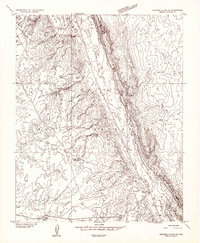
 1886 Echo Cliffs1886 Print · USGSArizona's northern frontier remains a rugged expanse of high plateaus and deep river canyons during the late nineteenth century. Researchers can trace early travel routes through Lee Ferry and locate vital water stops like Jacobs Pools and Bitter Spring.2 unique versions available
 - 1891 Map of Echo Cliffs
 1891 Echo Cliffs1891 Print · USGSNorthern Arizona's river corridors and canyonlands appear here in the late nineteenth century, centered on the vital river crossing at Lee Ferry. Trace early frontier settlements like Tuba City and remote watering holes such as Navajo Spring and Jacobs Pools.8 unique versions available
 - 1954 Map of Shinumo Altar NE, 1955 Print
 1954 Shinumo Altar NE1955 Print · USGSThe Navajo Indian Reservation in northern Arizona is captured here during the mid-fifties, centered on the high-desert terrain of Cornfield Valley. Researchers can locate isolated water sources and outposts like Cedar Ridge Trading Post, McClellan Tanks, and Eagle Nest Reservoir.
 - 1954 Map of Shinumo Altar, 1956 Print
 1954 Shinumo Altar1956 Print · USGSCoconino County in the mid-1950s reveals a high-desert landscape of the Navajo Indian Reservation shaped by grazing and geological granduer. Researchers can trace remote water sources like McClellan Tanks and the social hub at Cedar Ridge Trading Post.2 unique versions available
 - 1956 Map of Marble Canyon, 1964 Print
 1956 Marble Canyon1964 Print · USGSNorthern Arizona and the borderlands of Utah are mapped here in the mid-fifties, showing a landscape defined by traditional trading posts and early uranium mining. Trace old routes between Tuba City and Kayenta, and locate historic sites like Lees Ferry and Inscription House Trading Post.4 unique versions available
 - 1959 Map of Marble Canyon
 1959 Marble Canyon1959 Print · USGSNorthern Arizona in the late fifties is a vast landscape of tribal lands and desert plateaus defined by the carving of the Colorado River. Trace family roots and regional history at Tuba City, the Chilchinbito Trading Post, or the ancient Inscription House Ruin.
 - 1961 Map of Marble Canyon
 1961 Marble Canyon1961 Print · USGSThe northern Arizona desert in the early sixties reveals a landscape of tribal lands and canyon crossings. Trace the old river life at Lees Ferry, find the Uranium mill at Tuba City, and locate the iconic Elephant Feet landmarks.
 - 1983 Map of Tuba City
 1983 Tuba City1983 Print · USGSThe Navajo Nation and the eastern rim of the Grand Canyon meet in this early 1980s survey of Coconino County. Genealogists and researchers can locate remote outposts like The Gap and Moenave alongside traditional water sites such as Klage Toh and Mesa Spring.2 unique versions available
 - 1988 Map of Cedar Ridge
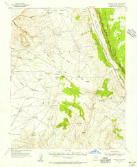
 1988 Cedar Ridge1988 Print · USGSCoconino County during the late twentieth century is shown as a high-desert landscape within the Navajo Indian Reservation. Researchers can trace early water management systems like Eagle Nest Reservoir and a series of Check Dams along Tanner Wash.
 - 2011 Map of Cedar Ridge, 2011 Print
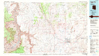
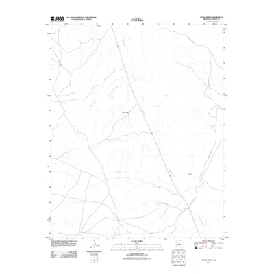 2011 Cedar Ridge2011 Print · USGSCovers Cedar Ridge, including Coconino County, United States, and other nearby areas
 - 2014 Map of Cedar Ridge, 2014 Print
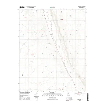 2014 Cedar Ridge2014 Print · USGSCovers Cedar Ridge, including Coconino County, United States, and other nearby areas
 - 2018 Map of Cedar Ridge, 2018 Print
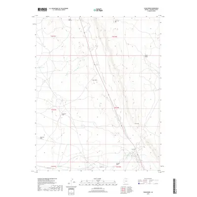 2018 Cedar Ridge2018 Print · USGSCovers Cedar Ridge, including Coconino County, United States, and other nearby areas
 - 2021 Map of Cedar Ridge, 2021 Print
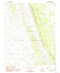
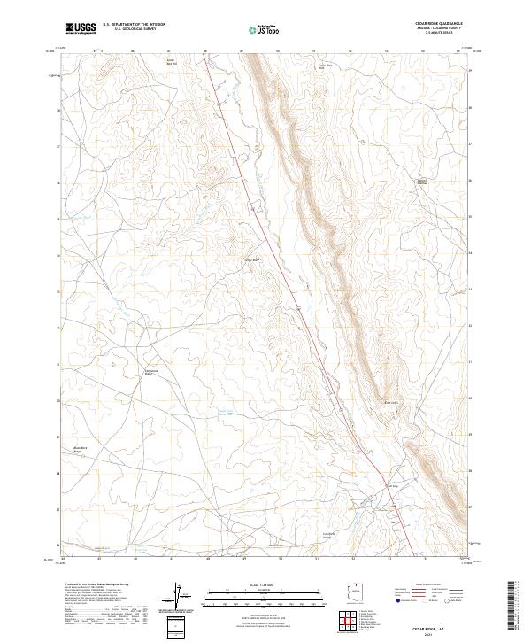 2021 Cedar Ridge2021 Print · USGSCoconino County's high-desert terrain is documented here in the early 2020s, centered on the settlement of Cedar Ridge. Researchers can trace the drainage patterns of Tanner Wash and Hamblin Wash or locate landforms like the Echo Cliffs and Cornfield Valley.
End of results
Showing maps 1-13 of 13
Top cities near Cedar Ridge
Frequently asked questions
- What are the different types of historical maps available for Cedar Ridge?
- What is the oldest map of Cedar Ridge?
- Where can I purchase historical maps of Cedar Ridge for my home or office?
- Where can I download high-res historical maps of Cedar Ridge?
- Are there historical topographic maps available for Cedar Ridge?
- Is there historical aerial imagery available for Cedar Ridge?
- Where are historical maps of Cedar Ridge sourced from?