1950s Maps of Old Leupp, Leupp
Explore 4 historic maps of Old Leupp from the 1950s. These maps offer a rare glimpse into what life looked like during the 1950s — showing old roads, neighborhoods, homes, and landmarks that have changed or disappeared over time.
Whether you're researching your family's past, planning a metal detecting trip, or studying how Old Leupp's landscape evolved across the 1950s, these high-resolution maps are a powerful tool for exploring the history of this region.
- Focus on a specific era: All maps on this page are from the 1950s, giving you a focused view of this time period.
- See what’s changed: Compare century-old streets, trails, and buildings to today's modern landscape using overlays and satellite layers.
- Research with precision: Use these maps for genealogy, historical research, land use analysis, or educational projects.
- View, download, or print: Maps are fully viewable online in high resolution, and can be downloaded or printed for your own records.
Start exploring Old Leupp's history through authentic maps from the 1950s. This is your window into the past.
Old Leupp, Leupp maps
(4)- 1954 Map of Flagstaff, 1966 Print
 1954 Flagstaff1966 Print · USGSNorthern Arizona in the mid-fifties shows a landscape of volcanic peaks and ancestral mesa villages linked by the iconic U.S. 66. Trace the path of the Atchison Topeka and Santa Fe through Winslow or explore the settlements of Old Oraibi and Kearns Canyon.3 unique versions available
 - 1955 Map of Winslow 2 SW, 1957 Print
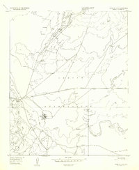 1955 Winslow 2 SW1957 Print · USGSThe mid-century Navajo Indian Reservation comes into focus along the Little Colorado River. Researchers can trace the layout of Leupp, find the Sunrise Trading Post, and locate the Sunrise Airfield at this pivotal moment in the region's development.
 - 1955 Map of Leupp, 1959 Print
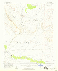 1955 Leupp1959 Print · USGSThe Navajo Nation high desert comes into focus during the mid-fifties, centered on the Little Colorado River and the rugged profile of Newberry Mesa. Researchers can trace the layout of Leupp, the Tolani Lake Day School, and the early path of the Leupp Oraibi Road.2 unique versions available
 - 1958 Map of Flagstaff
 1958 Flagstaff1958 Print · USGSNorthern Arizona in the late fifties is captured here during the heyday of Route 66 and the expansion of the high desert rail corridors. Researchers can trace historic mesa settlements like Old Oraibi or follow the path of the Atchison Topeka and Santa Fe through Flagstaff and Winslow.
End of results
Showing maps 1-4 of 4
Top cities near Old Leupp
Frequently asked questions
- What are the different types of historical maps available for Old Leupp?
- What is the oldest map of Old Leupp?
- Where can I purchase historical maps of Old Leupp for my home or office?
- Where can I download high-res historical maps of Old Leupp?
- Are there historical topographic maps available for Old Leupp?
- Is there historical aerial imagery available for Old Leupp?
- Where are historical maps of Old Leupp sourced from?