2000s (21st Century) Maps of Aztec Lodge, Arizona
Explore 5 historic maps of Aztec Lodge from the 2000s (21st Century). These maps offer a rare glimpse into what life looked like during the 2000s — showing old roads, neighborhoods, homes, and landmarks that have changed or disappeared over time.
Whether you're researching your family's past, planning a metal detecting trip, or studying how Aztec Lodge's landscape evolved across the 2000s, these high-resolution maps are a powerful tool for exploring the history of this region.
- Focus on a specific era: All maps on this page are from the 2000s, giving you a focused view of this time period.
- See what’s changed: Compare century-old streets, trails, and buildings to today's modern landscape using overlays and satellite layers.
- Research with precision: Use these maps for genealogy, historical research, land use analysis, or educational projects.
- View, download, or print: Maps are fully viewable online in high resolution, and can be downloaded or printed for your own records.
Start exploring Aztec Lodge's history through authentic maps from the 2000s. This is your window into the past.
Aztec Lodge, AZ maps
(5)- 2004 Map of Aztec Peak, 2007 Print
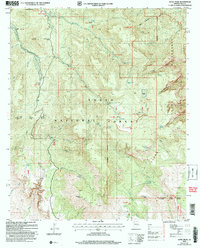 2004 Aztec Peak2007 Print · USGSThe high country of Gila County comes into focus in this early 2000s study, detailing the transition from rugged peaks to deep wilderness canyons. Researchers can trace the heritage of the Sierra Ancha through family holdings like Armer Ranch and mining remnants at Asbestos Point.
 - 2011 Map of Aztec Peak, 2011 Print
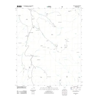 2011 Aztec Peak2011 Print · USGSCovers Aztec Lodge, including Rose Creek Lodge, Gila County, and other nearby areas
 - 2014 Map of Aztec Peak, 2014 Print
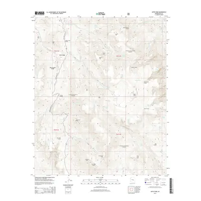 2014 Aztec Peak2014 Print · USGSCovers Aztec Lodge, including Rose Creek Lodge, Gila County, and other nearby areas
 - 2018 Map of Aztec Peak, 2018 Print
 2018 Aztec Peak2018 Print · USGSCovers Aztec Lodge, including Rose Creek Lodge, Gila County, and other nearby areas
 - 2021 Map of Aztec Peak, 2021 Print
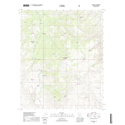
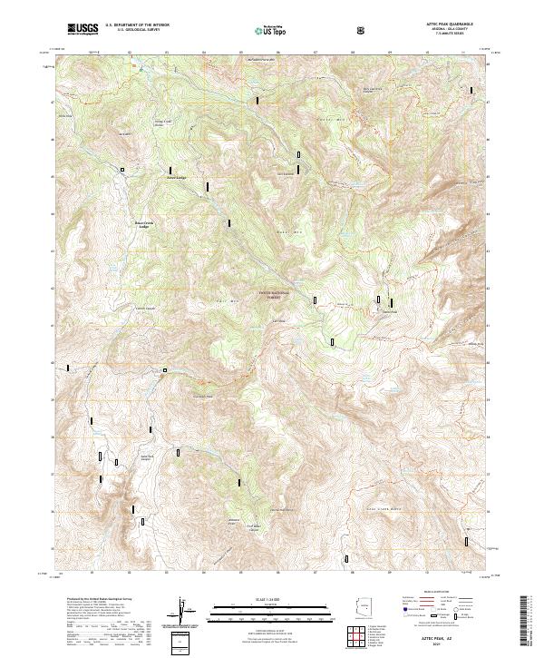 2021 Aztec Peak2021 Print · USGSThe Sierra Ancha wilderness of Gila County is captured here in the early twenty-first century, showing a landscape defined by deep canyons and mountain lodges. Researchers can trace the rugged topography from Asbestos Point to Devils Chasm, locating remote water sources like Knoles Hole Spring.
End of results
Showing maps 1-5 of 5
Frequently asked questions
- What are the different types of historical maps available for Aztec Lodge?
- What is the oldest map of Aztec Lodge?
- Where can I purchase historical maps of Aztec Lodge for my home or office?
- Where can I download high-res historical maps of Aztec Lodge?
- Are there historical topographic maps available for Aztec Lodge?
- Is there historical aerial imagery available for Aztec Lodge?
- Where are historical maps of Aztec Lodge sourced from?