Old Maps of Seneca, Arizona for Hiking & Exploration
Hike through history with 15 historic maps of Seneca. Explore old trails, ghost towns, and forgotten backroads — perfect for outdoor adventurers and local explorers.
- Rediscover forgotten places: Map out old mining camps, roads, and footpaths that no longer exist on modern maps.
- Layer with modern tools: Combine with LiDAR or satellite views to plan hikes through historical terrain.
- Made for exploration: Popular among hikers, overlanders, and local history lovers.
Use these maps to find adventure and explore the hidden past of Seneca.
Seneca, AZ maps
(15)- 1922 Map of Chrysotile
 1922 Chrysotile1922 Print · USGSGila County's mining and ranching frontier is documented in the early twenties during a period of rapid reconnaissance mapping. Researchers can locate early outposts and water sources such as McMillanville, Chrysotile, and Ash Spring near the Fort Apache Reservation boundary.
 - 1946 Map of Blue House Mtn, 1956 Print
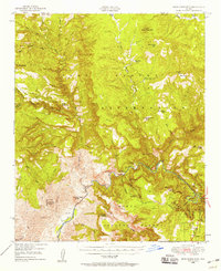 1946 Blue House Mtn1956 Print · USGSCentral Arizona's canyon country comes alive in the mid-1940s, showing the intersection of mining, ancient history, and tribal lands. Researchers can trace historic operations like the Regal Mine and Apache Mine alongside the Samrace Cliff Dwellings.2 unique versions available
 - 1951 Map of Blue House Mtn
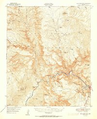 1951 Blue House Mtn1951 Print · USGSGila County canyon country in the early fifties reveals a landscape of industrial mining and ancient archaeology. Trace deep-canyon mineral workings at the Regal Mine and Canadian Mines, or locate historical sites like the Sanrace Cliff Dwellings.2 unique versions available
 - 1954 Map of Mesa, 1968 Print
 1954 Mesa1968 Print · USGSCentral Arizona in the mid-fifties reveals the rapid growth of the Valley of the Sun alongside the deep-rooted mining districts of the eastern mountains. Genealogists and researchers can trace the expansion of Mesa and Chandler or locate legacy operations at Inspiration Mine and the Magma Arizona railroad.4 unique versions available
 - 1957 Map of Mesa
 1957 Mesa1957 Print · USGSCentral Arizona's desert valleys and high-mountain mining districts come alive in the mid-fifties. Researchers can trace the early layout of Mesa and Phoenix or locate remote sites like Inspiration Mine and Arizona State College.
 - 1958 Map of Mesa
 1958 Mesa1958 Print · USGSMid-century Arizona comes alive in this survey of the valley and high desert, where urban growth begins to transform the landscape. Genealogists and researchers can trace the rail-and-mine economy through Inspiration Mine and old stops like Rittenhouse and Magma.
 - 1960 Map of Mesa
 1960 Mesa1960 Print · USGSThe Salt River Valley and Superstition wilderness are captured here during a era of rapid post-war growth. Researchers can trace the mid-century footprints of Williams AF Base and Arizona State College or locate the deep-rock shafts of the Old Dominion Mine and Magma Mine.
 - 1964 Map of Mesa
 1964 Mesa1964 Print · USGSCentral Arizona in the mid-1960s reveals a landscape defined by rapid desert urbanization and a massive copper mining industry. Genealogists and historians can trace the growth of Phoenix or explore the mining camps and operations at Miami Mine and Magma Mine.
 - 1988 Map of Mule Hoof Bend
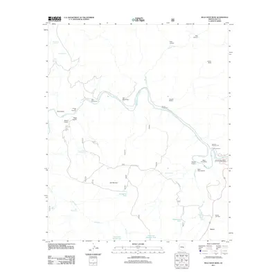
 1988 Mule Hoof Bend1988 Print · USGSGila County’s remote canyon country is captured here in the late 1980s, where three major public and tribal lands meet along the Salt River. Researchers can trace the era’s active mining landscape at the Apache Mine and Regal Mine, or locate local landmarks like the Jimana Inn near Seneca.2 unique versions available
 - 1992 Map of Seneca, 1993 Print
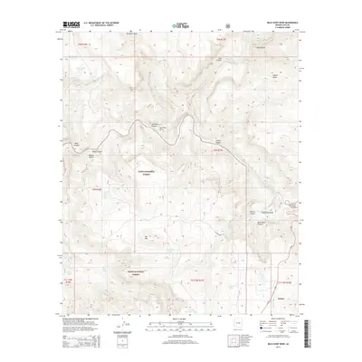
 1992 Seneca1993 Print · USGSGila County in the early nineties remains a wild landscape of tribal reservations and national forest. Researchers can trace historic mining at the Old Owen McMillenville Mine, locate the remote settlement of Cibecue, and map the rugged drainages of the Salt River.2 unique versions available
 - 2004 Map of Mule Hoof Bend, 2007 Print
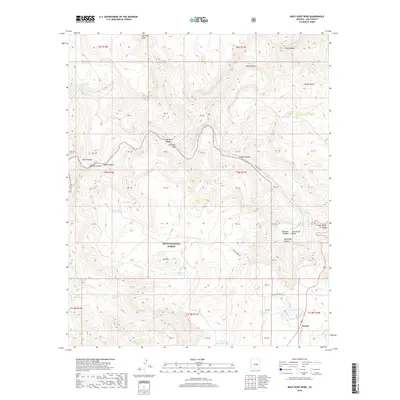
 2004 Mule Hoof Bend2007 Print · USGSGila County's high desert and canyon lands are captured here at the turn of the millennium, where three tribal and national forest boundaries converge. Researchers can trace decades of mining history at the Fiber King Mine or locate the Seneca Lake recreation area near the historic Salt River crossing.
 - 2011 Map of Mule Hoof Bend, 2011 Print
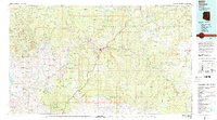
 2011 Mule Hoof Bend2011 Print · USGSCovers Seneca, including Gila County, United States, and other nearby areas
 - 2014 Map of Mule Hoof Bend, 2014 Print
 2014 Mule Hoof Bend2014 Print · USGSCovers Seneca, including Gila County, United States, and other nearby areas
 - 2018 Map of Mule Hoof Bend, 2018 Print
 2018 Mule Hoof Bend2018 Print · USGSCovers Seneca, including Gila County, United States, and other nearby areas
 - 2021 Map of Mule Hoof Bend, 2021 Print
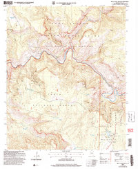
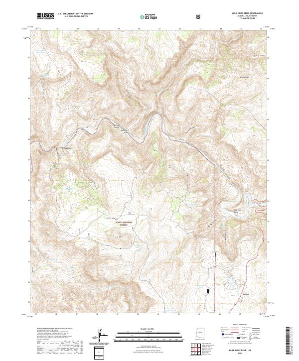 2021 Mule Hoof Bend2021 Print · USGSGila County's steep canyon country is captured here during the early twenty-first century, centered on the dramatic Mule Hoof Bend. Researchers can trace the isolated settlement of Seneca and remote mountain tracks like Phillips Mine Rd near Ash Mtn.
End of results
Showing maps 1-15 of 15
Frequently asked questions
- What are the different types of historical maps available for Seneca?
- What is the oldest map of Seneca?
- Where can I purchase historical maps of Seneca for my home or office?
- Where can I download high-res historical maps of Seneca?
- Are there historical topographic maps available for Seneca?
- Is there historical aerial imagery available for Seneca?
- Where are historical maps of Seneca sourced from?